Solved

Geometry creation and correction

  • October 22, 2018
  • 5 replies
  • 63 views

todd_davis
Influencer
Forum|alt.badge.img+23

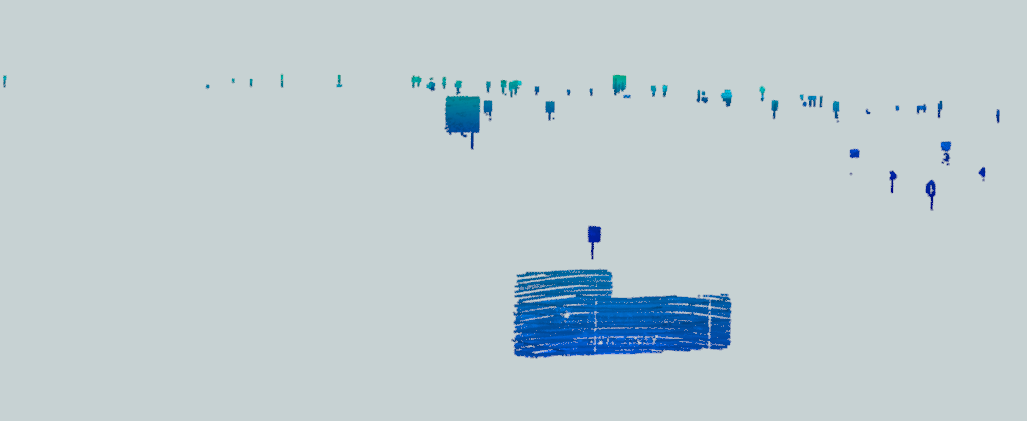
I have been supplied a LAS files to extract features from. FME has been able to do a pretty good job at it and I have been able to extract the likes of Road Markings and Signs from the pointcloud. However, I am hoping that there may a few more idea of refining the process to get "nicer" features from the data.

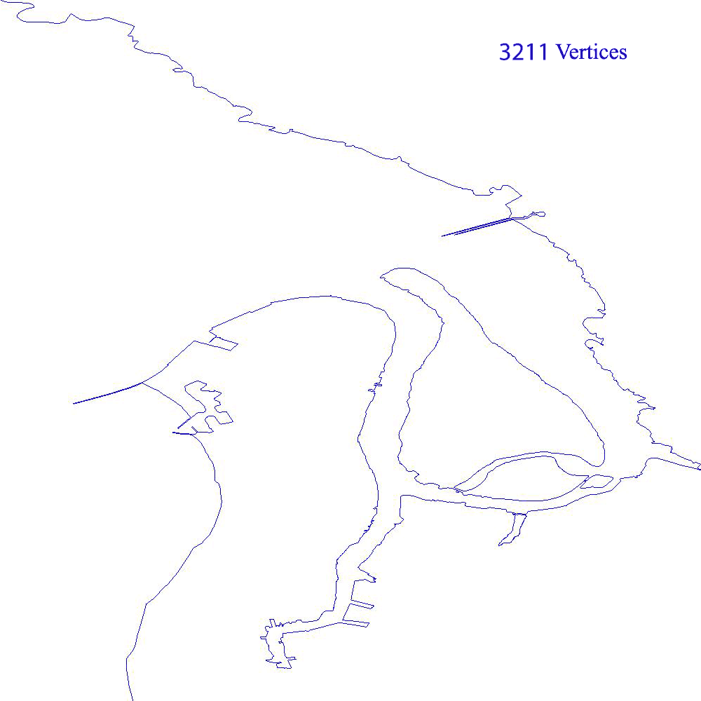
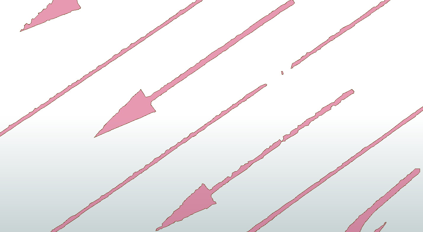
For the road marking, I really want a process that looks at the outer points and removes all the vertices in between. I can't seem to find a "generalization/smoothing" that does it nicely. (Thanks to @dmitribagh for the initial workspace)


For the signs, I have just have got to the point to of extracting from the LAS. So I need to create into a vertical surface/polygons. I have an idea to extract the full surface in much the same way as above, although to I believe for each sign, I will:

- User Centrelinereplacer to extract the angle of the sign.

- coordinateswapper, so that I am looking down on the sign face

- Rotate the sign using angle to look at the full face

- build surface (also need the same "generilization/smoothing" as above)

- rotate back and coordinate swap


Would be interested in others perspective on how to do this, and maybe the geometry team might have some ideas? @oliviawasalski


LAS signs in 3D

Best answer by jdh

For the road markings I would suggest implementing a visvalingam simplification algorithm. See https://bost.ocks.org/mike/simplify/ for a basic introduction. There are a fair number of python implementations on github.

Here's a visual of the simplification, that I did in FME.

This post is closed to further activity.
It may be an old question, an answered question, an implemented idea, or a notification-only post.
Please check post dates before relying on any information in a question or answer.
For follow-up or related questions, please post a new question or idea.
If there is a genuine update to be made, please contact us and request that the post is reopened.

5 replies

Hi @todd_davis! I'm afraid I don't have a solution. I've asked @JovitaAtSafe to make sure we follow up when we have some ideas.


jovitaatsafe
Safer
Forum|alt.badge.img+11
  • Safer
  • 635 replies
  • October 25, 2018

Hi @todd_davis,

Thanks for your question! Because we are extracting from a point cloud, I'm not sure that we're going to be able to get quite clean edges (I learned from one long sitting trying to create CityGML from a LAS file). The only thing I can think of in terms of methods for smoothing are from this article on Creating Boundaries from a Point Cloud.


What's the intended output format and overarching goal of the project? I can't promise that I'll be able to come up with anything, but if you're able to share a sample of your extracted signs data perhaps either I or someone else in the community who's interested can come up with an alternative method or perspective? Your plan so far sounds solid (haha...geometry...)! Are you having any success with your method so far?


jdh
Contributor
Forum|alt.badge.img+37
  • Contributor
  • 2002 replies
  • Best Answer
  • October 25, 2018

For the road markings I would suggest implementing a visvalingam simplification algorithm. See https://bost.ocks.org/mike/simplify/ for a basic introduction. There are a fair number of python implementations on github.

Here's a visual of the simplification, that I did in FME.


todd_davis
Influencer
Forum|alt.badge.img+23
  • Author
  • Influencer
  • 313 replies
  • October 28, 2018

Hi,

Thanks Olivia, Jovita and Joanna. Joanna, that simplification looks like it could be very useful, so I will give it a go when I get a chance. If anyone else wants to see if they can master this process, attached is a shapefile of some road markings and a LAS of signs downloads.zip


jdh
Contributor
Forum|alt.badge.img+37
  • Contributor
  • 2002 replies
  • October 29, 2018

Hi,

Thanks Olivia, Jovita and Joanna. Joanna, that simplification looks like it could be very useful, so I will give it a go when I get a chance. If anyone else wants to see if they can master this process, attached is a shapefile of some road markings and a LAS of signs downloads.zip

Here's your data with a 90% vertex reduction, to give you an idea of what can be accomplished.


If it were me, I would try to smooth out the data a little first, before applying the visvalingam simplification.


markingssimplified.zip