Hello, I have a point shapefile containing every aeronautical obstruction in the UK above 80ft. I am working with Largescale mapping and need to generalise the points so as not to clutter the chart. I need to merge multiple points into single points based on their proximity to each other and other attributes. Then create a new attribute stating that the new point is now a 'Multipoint'. Additionally I will need to retain the metadata of the highest obstruction of the generalised points.

Thank you very much in advance for any assistance you can provide.

@1spatialdave

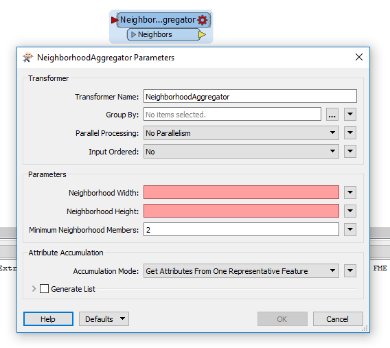
The transformer you want to have a look at is the NeighborhoodAggregator.

Set a maximum area size (proximity) and the Group by (attributes that need to be the same).

Then generate a list and sort that list (ListSorter) by height descending to get the attributes from the highest structure.

Finally use the CenterPointReplacer to replace the aggregate points by the Center point.

How would you set a maximum area size using NeighborhoodAggregator?


How would you set a maximum area size using NeighborhoodAggregator?


Using the (red) parameters of Width and Height.


How would you set a maximum area size using NeighborhoodAggregator?


Be aware that the area height and width values are in ground units of your coordinate system. Meaning that if your coordinate system is in meters, the values are interpreted as meters, etc.

Reply