
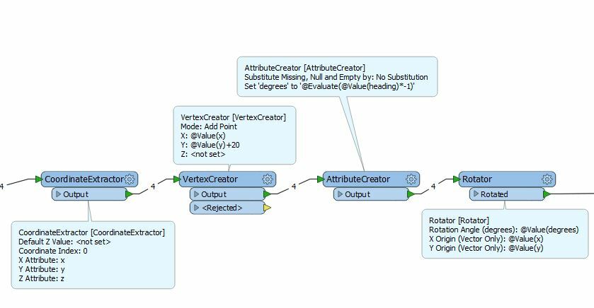
I have a collection of points and for each point a heading is recorded. What I want to do is create lines for a specified distance (say 20 meters) in the direction of the heading recorded for each point. The start point will be the X/Y of the point.
Does anyone have any ideas on how to get started with this?


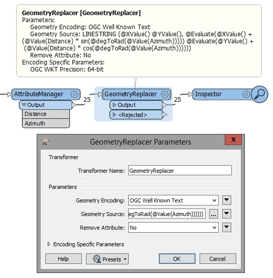 The Geometry Source field contains this formula: