
")
Hei
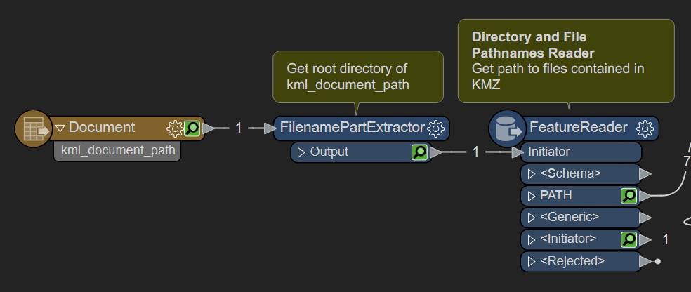
I am trying to convert a kml file into a geodatabase, because the kml file has attached pictures that were taken. If I do it via arcgis software I don't get the information, just the points. Via FME I can get the points, the information about the points, and that existes some jpg files attached to the points, but not the jpg files.
Shapefiles don't allow to attach files into, but geodatabase allows that.
Someone with experience on that?
In attachment you can find an example to teste.
Thank you in advance,
Artur


 You should then be able to use this information to write attachments as shown in
 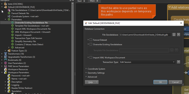 I will take a look again tomorrow. In the meanwhile, if you understand what I am doing wrong, feel free :)