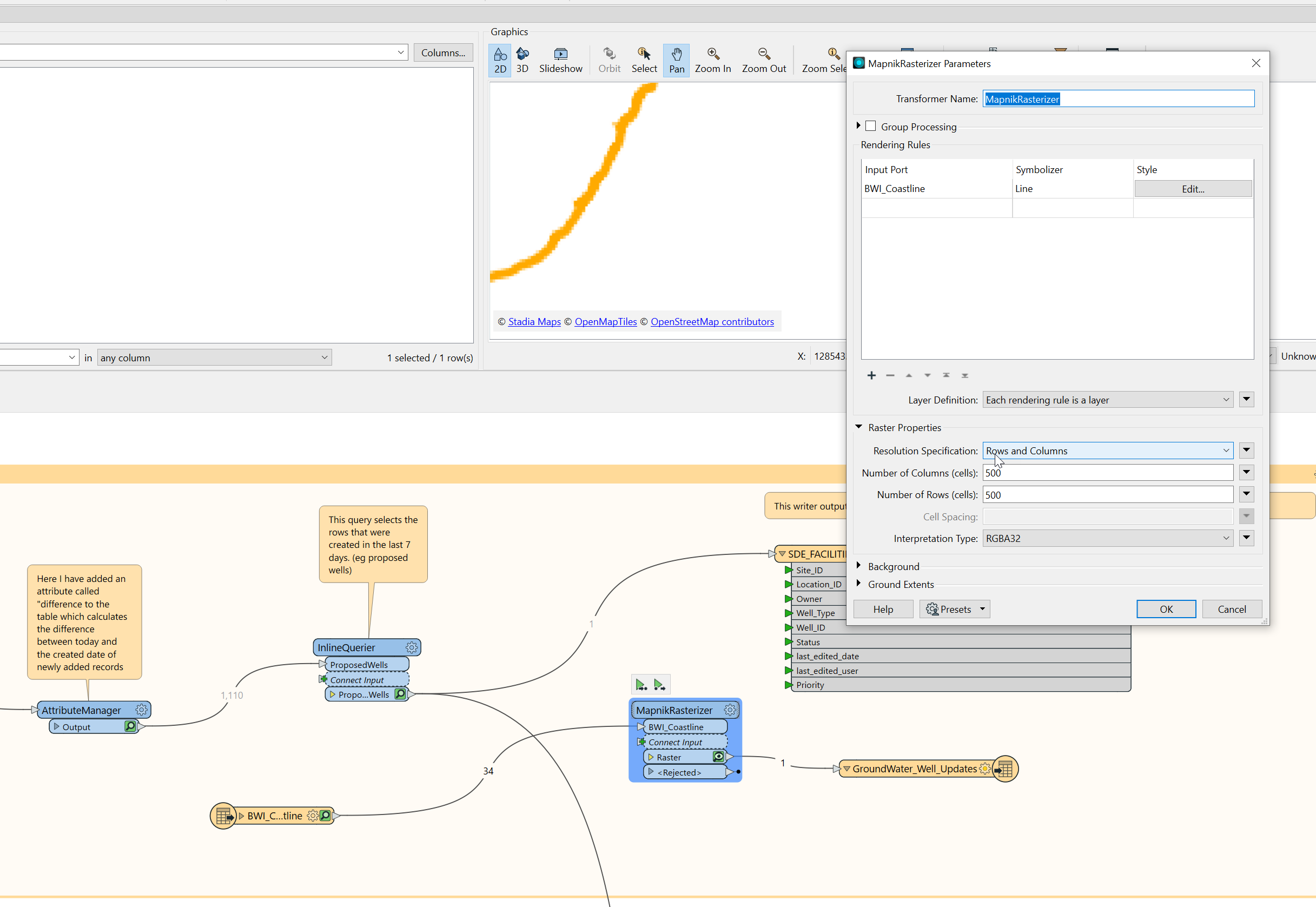
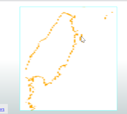
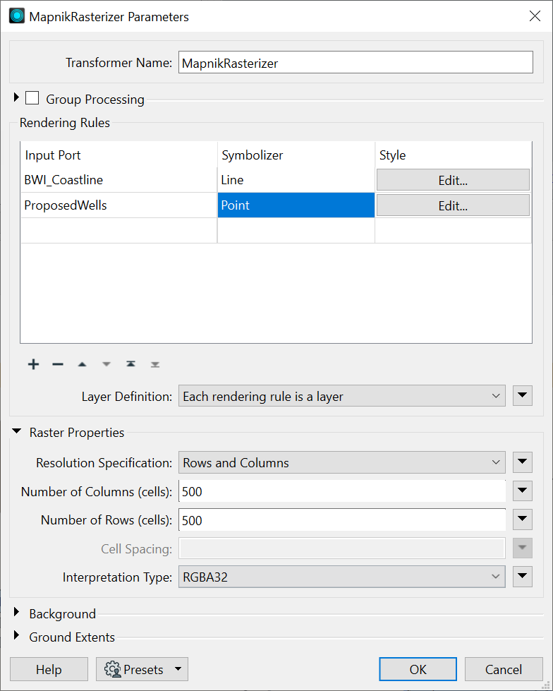
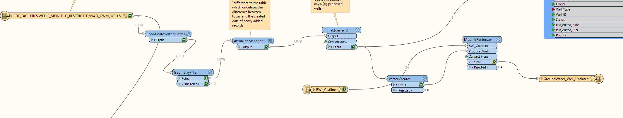
I have a workbench where I am reading data from a SDE looking for rows updated in the last 7 days then exporting to an excel file. That is working well. I’m also using mapnikrasteriser to create a map and export a tiff image however the new records have no geometry defined so won't show up on my map.
What would be the best option to calculate geometry for those new records?