Question

Published Parameter- choice list must convert schema name in lower case and alwayes update automatically for ESRI Geodatabase(ArcSDE Geodb) reader


Badge

Dear everyone,

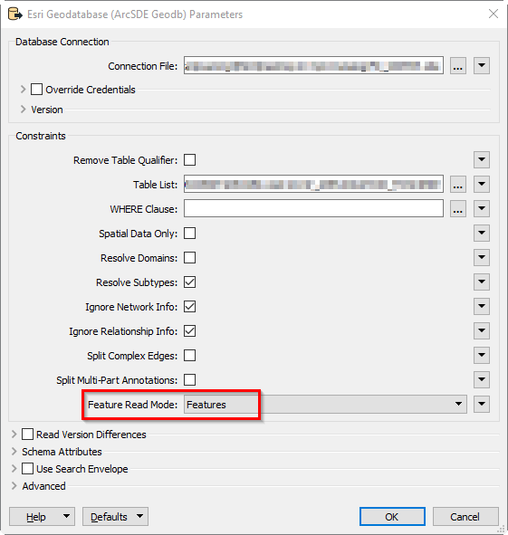
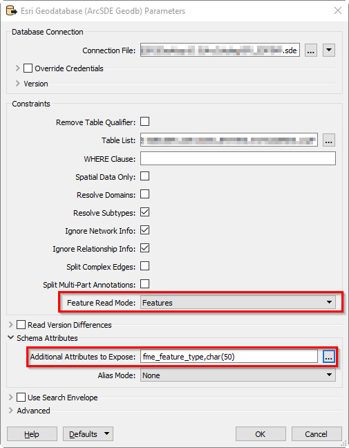
I have an fme workbench which is maintaing a connection between my sql server enterprise gdb and having some paramaters, I am using it for data download. It is facing two problem, 1) fme is reading featureclass name as we see inside arcgis catalog (i.e, DBO.test) while in sql server we find it as dbo.TEST. We have also a automatic process to read metadata where the table name we read as dbo.TEST. But our fme workflow is reading it as DBO.test so our download button is not working. How can I change the schema name in lowercase?

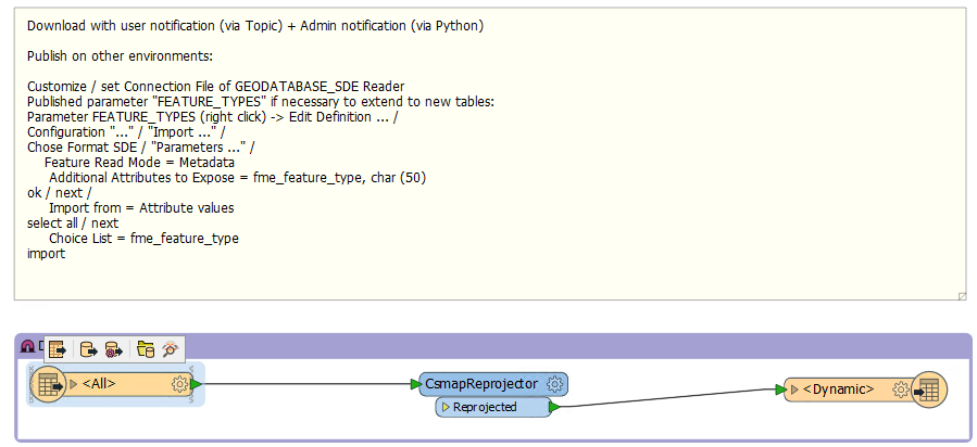
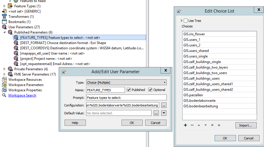
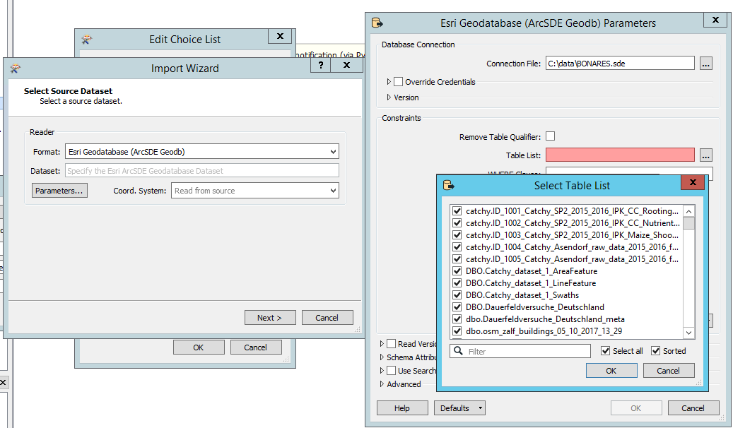
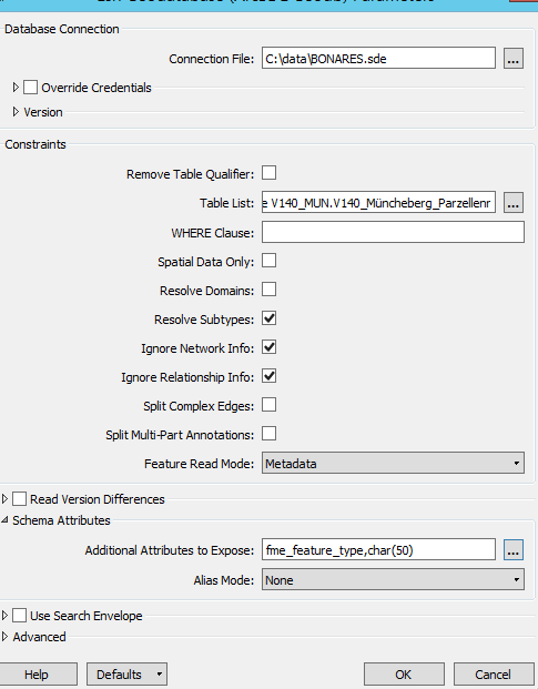
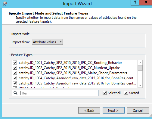
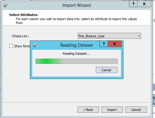
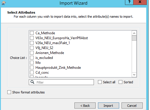
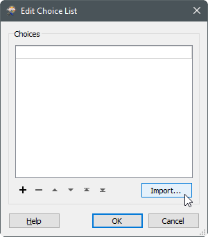
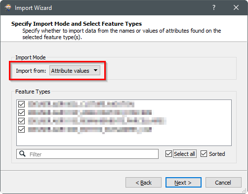
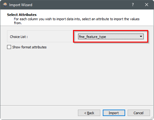
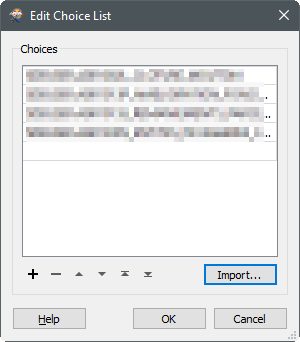
ANother this is , i was trying to use a choice list for automatically updating new featureclass or table name inside reader, but when I import it as fme_feature_type , it is importing nothing!


10 replies

Userlevel 4

1) If you need the SQL Server table names, try using the SQL Server Non-Spatial reader rather than the SDE reader when importing the table names.

2) When you connect to the SDE instance, make sure to set "Feature read mode" to "Features" and not "Metadata"

Badge

1) If you need the SQL Server table names, try using the SQL Server Non-Spatial reader rather than the SDE reader when importing the table names.

2) When you connect to the SDE instance, make sure to set "Feature read mode" to "Features" and not "Metadata"

Thanks for your answer, but I think this is not the exact solution for me, I have tried both Non-spatial and SDe connection, problem is at the end it is importing "attribute name / attribute values" which means Field names or its values. I need schema.table/featureclass name, that is why i have tried to use metadata (fme_feature_type).


See it is importing attribute :


Regards


Muqit


Userlevel 4
Thanks for your answer, but I think this is not the exact solution for me, I have tried both Non-spatial and SDe connection, problem is at the end it is importing "attribute name / attribute values" which means Field names or its values. I need schema.table/featureclass name, that is why i have tried to use metadata (fme_feature_type).


See it is importing attribute :


Regards


Muqit


The metadata read mode reads the ArcGIS Metadata XML from the SDE database, it's not a reference to the "table metadata" as such.


You should set read mode to to "Features", expose "fme_feature_type" and then use that attribute when importing the attribute values.


Works for me, anyway.
Userlevel 4

Here's a step-by-step:

You probably have to manually check all the relevant tables here.

Badge
The metadata read mode reads the ArcGIS Metadata XML from the SDE database, it's not a reference to the "table metadata" as such.


You should set read mode to to "Features", expose "fme_feature_type" and then use that attribute when importing the attribute values.


Works for me, anyway.
Thanks, but for me choice list is importing nothing !


Badge

Here's a step-by-step:

You probably have to manually check all the relevant tables here.

Yes, i have done all the steps, but my choice list is empty! What could be the reason?


Userlevel 4
Yes, i have done all the steps, but my choice list is empty! What could be the reason?


Weird, never seen that one before. Let's see if anyone else has an idea, otherwise you may want to contact Safe support.
Badge
Weird, never seen that one before. Let's see if anyone else has an idea, otherwise you may want to contact Safe support.
I have found in Translation Log the following error and it quits:


An error occurred while attempting to open the table, feature class or relationship class 'v140_mun.ID_16_Ertrag'. The error number from ArcObjects is: '-2147216067'. The error message from ArcObjects is: {Invalid column definition [Column name 'Hauptprodukt_Frischmasse_Kg_Ernteflaeche' exceeds 31 characters long.]} Closing the Geodatabase reader


Userlevel 4
I have found in Translation Log the following error and it quits:


An error occurred while attempting to open the table, feature class or relationship class 'v140_mun.ID_16_Ertrag'. The error number from ArcObjects is: '-2147216067'. The error message from ArcObjects is: {Invalid column definition [Column name 'Hauptprodukt_Frischmasse_Kg_Ernteflaeche' exceeds 31 characters long.]} Closing the Geodatabase reader


Good find, that's most likely the culprit. Try excluding that particular table.
Badge
Weird, never seen that one before. Let's see if anyone else has an idea, otherwise you may want to contact Safe support.
After excluding those two table, even my choice list is importing nothing ....! I tried with 6 tables/featureclass , this is providing me following errors:


ArcSDE release: '10.0'. Underlying database: 'SQL Server' R_68 Reader: Using classic geometry


All network information will be ignored. As a result, edges will be treated as polyline features and junctions will be treated as point features


All relationship information will be ignored. As a result, simple relationships will not be read, and attributed relationships will be read as tables


Reading table/feature class 'c.ID_1001_Rooting_Behavior'


Reading table/feature class 'c.ID_1002_Nutrient_Uptake'


Reading table/feature class 'c.ID_1003_Shoot_Parameters'


Reading table/feature class 'c.ID_1004_AS_raw_data_15_16'


Reading table/feature class 'c.s2_AS_raw_data_15_16'


Reading table/feature class 'DBO.dataset_1_AreaFeature'


FME Configuration: Source coordinate system for reader R_68[GEODATABASE_SDE] set to `_LL-WGS84_0' as read from input data


Coordinate System `_LL-WGS84_0' parameters: CS_NAME=`_LL-WGS84_0' DESC_NM=`WGS84 Lat/Longs' DT_NAME=`WGS84' ESRI_WKT=`GEOGCS["GCS_WGS_1984",DATUM["D_WGS_1984",SPHEROID["WGS_1984",6378137.0,298.257223563]],PRIMEM["Greenwich",0.0],UNIT["Degree",0.0174532925199433]]' GROUP=`LL' MAP_SCL=`1' PROJ=`LL' QUAD=`1' SCL_RED=`1' UNIT=`DEGREE'


Reading table/feature class 'DBO.dataset_1_LineFeature'


Reading table/feature class 'DBO.dataset_1_Swaths'


Reading table/feature class 'DBO.Dd'


Coordinate system of reader identified by keyword `R_68' has changed from `_LL-WGS84_0' to `_LL-WGS84_1'


Coordinate System `_LL-WGS84_1' parameters: CS_NAME=`_LL-WGS84_1' DESC_NM=`WGS84 Lat/Longs' DT_NAME=`WGS84' ESRI_WKT=`GEOGCS["WGS 84",DATUM["WGS_1984",SPHEROID["WGS 84",6378137.0,298.257223563]],PRIMEM["Greenwich",0.0],UNIT["degree",0.0174532925199433]]' GROUP=`LL' MAP_SCL=`1' PROJ=`LL' QUAD=`1' SCL_RED=`1' UNIT=`DEGREE'


Reading table/feature class 'dbo.ddd_meta'


Coordinate system of reader identified by keyword `R_68' has changed from `_LL-WGS84_1' to `'


Reading table/feature class 'dbo.osm_buildings_05_10_2017_13_29'


FME Configuration: Source coordinate system for reader R_68[GEODATABASE_SDE] set to `ETRS89.UTM-33N_mhz' as read from input data


Coordinate System `ETRS89.UTM-33N_mhz' parameters: CS_NAME=`ETRS89.UTM-33N_mhz' DESC_NM=`ETRS89 / UTM zone 33N mit halber Zonenangabe (7Stellen)' DT_NAME=`ETRS89/01' GROUP=`UTMN' MAP_SCL=`1' PARM1=`15' PROJ=`TM' QUAD=`1' SCL_RED=`0.9996' SOURCE=`ESRI Germany' UNIT=`METER' X_OFF=`3500000' ZERO_X=`0.0001' ZERO_Y=`0.0001'


Closing the Geodatabase reader


Reply