


I have one large elevation model and numerous smaller elevation models (same resolution) which are within the area of the larger elevation model. The areas of the smaller elevation models are generated from a point cloud and clipped out according to a polygon (bridge). Now I want to merge the smaller elevation model areas into the larger DEM (wherever the smaller elevation models have a value, this should be used and if they have no value, the large elevation model should be used. My attempts with the RasterMosaicer unfortunately fail, because I cannot influence which elevation model is the "last" one. Is there another possibility to combine the different elevation models?


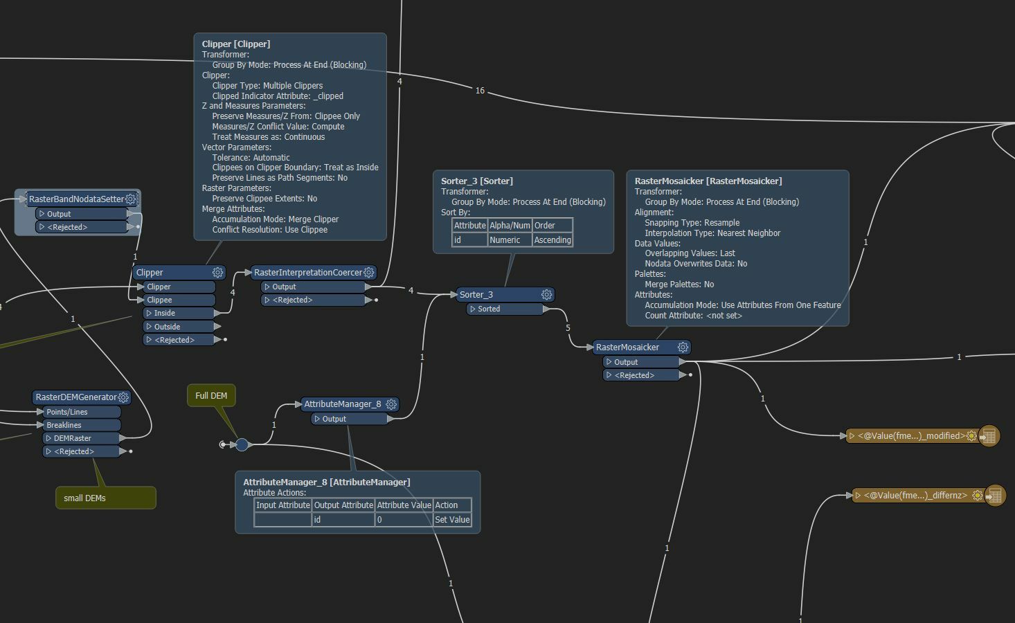 I think the problem is that I am not clear how I can influence the order. I have two inputs:
Reply
Rich Text Editor, editor1
Editor toolbars
Press ALT 0 for help
Helpful Members This Week


Enter your E-mail address. We'll send you an e-mail with instructions to reset your password.