Hello all,
We have previously showcased the FME-QGIS Connector Plugin. We have just released the QGIS-FME Connector Algorithm Plugin. What is the difference between the two? The first being a tool can just be opened and used to process some layers on the fly and load the results into QGIS back as a temporary or physical GeoJSON file, whereas the second is used a a QGIS provider or an algorithm; in QGIS terms it is a tool that processes the data.
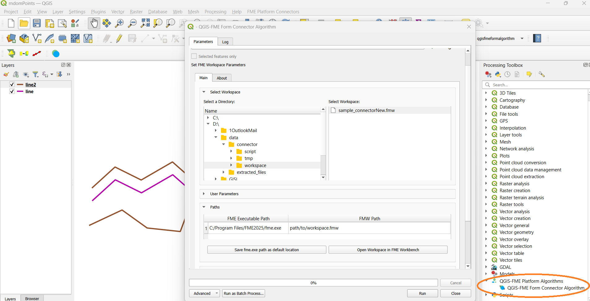
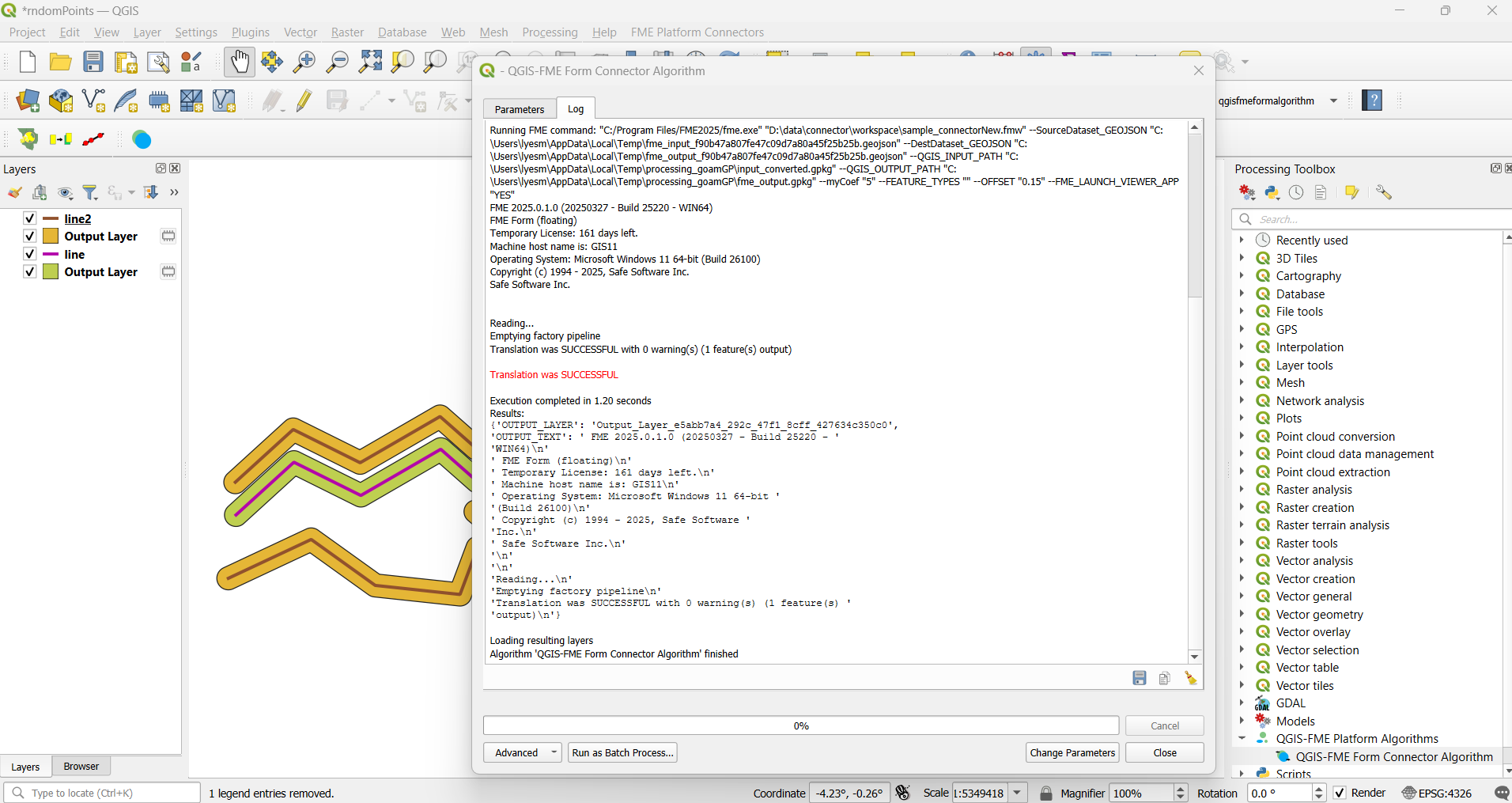
Think of it as having the WorkspaceRunner inside QGIS. Yes, you can select a layer in QGIS, rotate the data using the QGIS Model Designer, run the data in FME Form to save it in DGN format then proceed with some process inside FME get back you data create convex hull then end back the data to FME to process it via the HTTPCaller in FME Flow then get back the results and load it back as a layer in QGIS. The user’s imagination is really the limit.
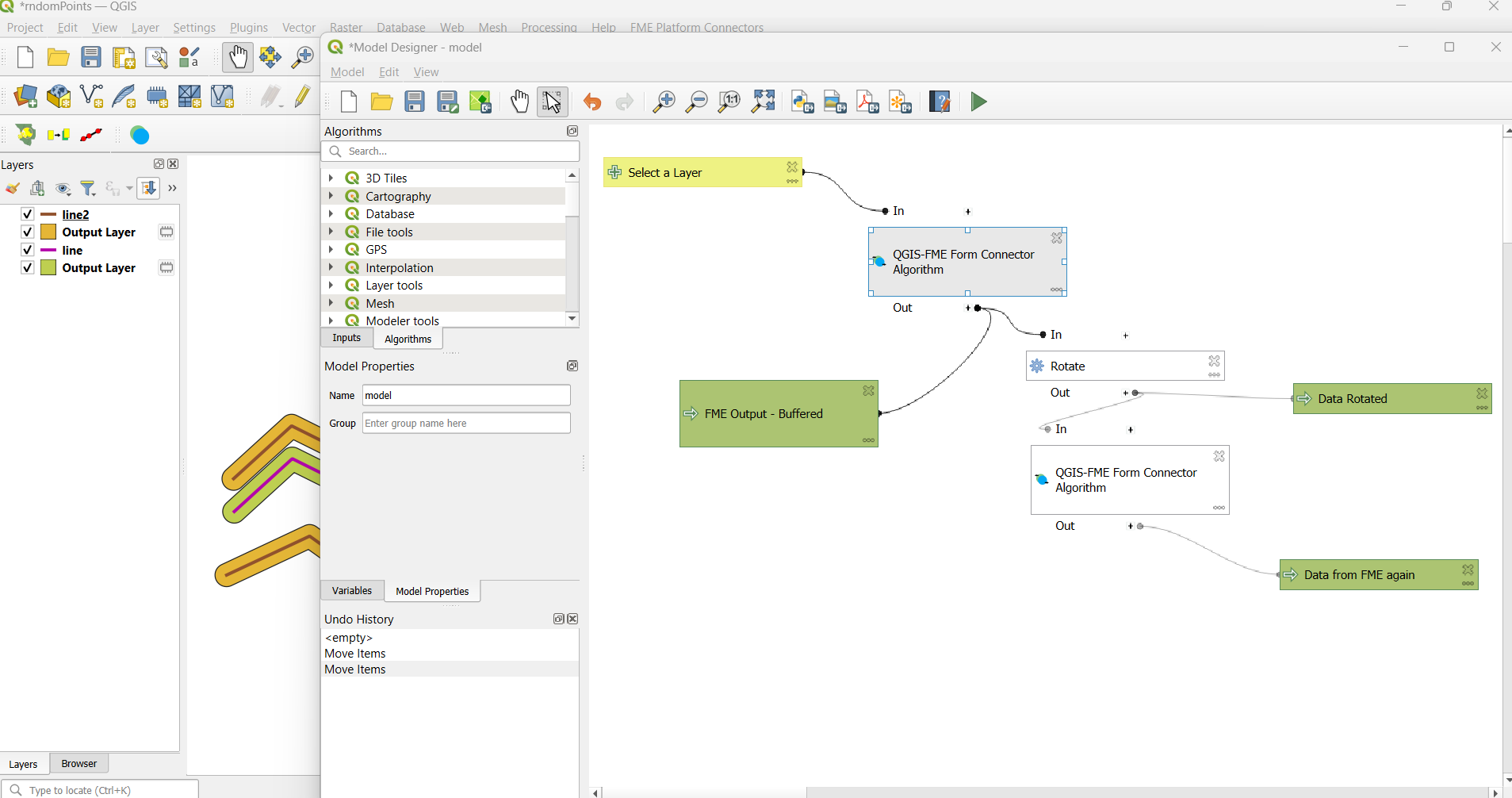
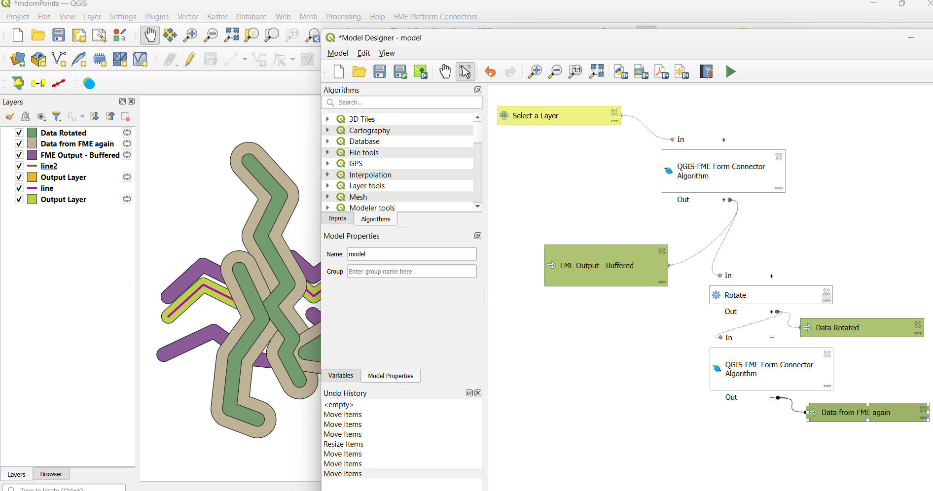
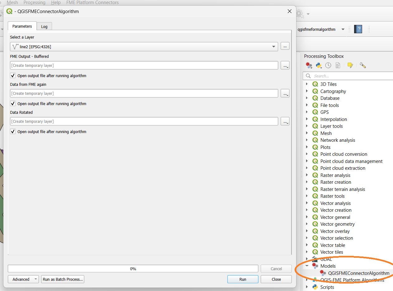
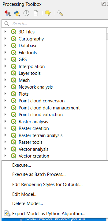
Once the model created, it can be saved and loaded as a tool in QGIS Toolbox,
Other things you can do to automate your conversion through QGIS is to simply convert the existing model to a Python script and run the script from outside QGIS.
This plugin is still experimental, if there are any bugs please let us know via email at mygis@gis.my.
Thank you for your support.