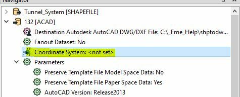
I am trying to convert Public Land Survey System (PLSS) township or section data (shapefile or file geodatabase feature class) into a DWG or DXF file for our cadastral lead using FME Workbench on Citrix. I generate a new workspace with Reader Format ESRI Shapefile (for example) and Writer Format Autodesk AutoCAD DWG/DXF. Both coordinate systems are NAD83 Idaho State Planes, East Zone, US Foot [EPSG #2241], so I set that for both Reader and Writer. I set Writer parameter to Extended Entity Data. When I bring output back into ArcMap or ArcPro, annotation table is empty and test dataset shows up off the coast of Nigeria. Our CAD person says same thing (that the dataset does not seem to have a coordinate system and no text attributes). Not sure what I am doing wrong.

Question
Need Help with GIS to CAD conversion
This post is closed to further activity.
It may be an old question, an answered question, an implemented idea, or a notification-only post.
Please check post dates before relying on any information in a question or answer.
For follow-up or related questions, please post a new question or idea.
If there is a genuine update to be made, please contact us and request that the post is reopened.


Login to the community
No account yet? Create an account
An FME Account is required to contribute
LoginEnter your E-mail address. We'll send you an e-mail with instructions to reset your password.