Hi All,
How to develop a tool that can be plugged into Cityworks map viewer to display an AutoCAD file format (*.dwg)?
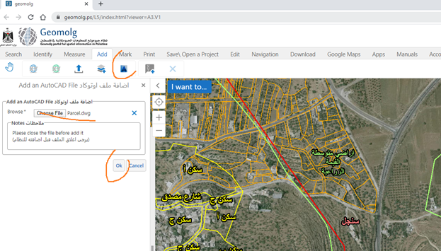
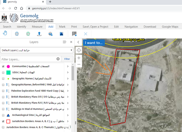
For example, we managed to develop a tool and plug it into Geocortex viewer so that end user can upload an AutoCAD file format and get it displayed into the viewer as shown in the screenshots below. The FME desktop and server capacity (creating workbench and publishing it) is used to develop the tool with particular configuration at the level of Windows (operating system) and Geocortex.
Currently, we are trying to develop the same tool (displaying AutoCAD file format) and plug it into Cityworks map viewer.
Is this something we can perform with the capacity of FME Desktop\\Server or an API Javascript code as it has been successfully completed for Geocortex viewer?


Thanks In advance
Lubna


