Can anyone explain the purpose of the extra xsi_nil attributes that accompany a Web Feature Service (WFS) data source?
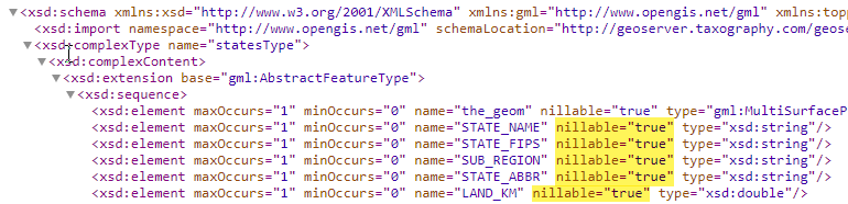
For example, when I create a WFS reader in FME for the topp:states demo layer of a stock GeoServer, the resulting table schema in my FME workspace includes extra attributes - one for each native attribute - named <attribute>_xsi_nil. Here's a screenshot highlighting the fields in question: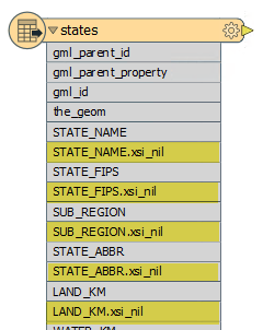
The data type for all of these xsi_nil fields is xml_boolean. This happens for all WFS layers I consume from a GeoServer.
What is the purpose of these extra fields?
And is there a way to configure the reader - or the GeoServer layer - to not cause these extra fields to be created?
Thanks