Hi all,
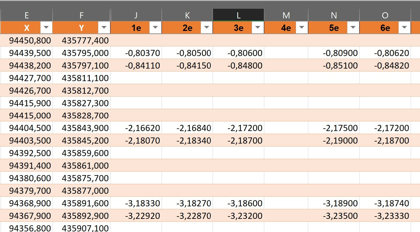
I have a table with (XYZ) coordinates measured in time. Each time the Z-value (field J and further) of the specific point changes. The XY-coordinates (field E and F) stay the same. Sometimes the Z-value is missing.
How can I project all of these point without manual adjustments to the table? So for the second row we have:
- 1st measurement: X=94439,5, Y=435795,0 and Z=-0,80370
- 2th measurement: X=94439,5, Y=435795,0 and Z=-0,80500
- 3th measurement: X=94439,5, Y=435795,0 and Z=-0,80600
- 4th measurement: X=94439,5, Y=435795,0 and Z= missing here so no projection
- and so further on

In the end I want to have a geodatabase.
Many thanks for you reply!
Alan


