
I have 2 shapefile files, each have about 13,000 features. I need to know what the minimum and maximum distance each feature of file 1 for example has in relation to file 2. How to do that?

Solved
Find Max and Min distance from polygons
 +9
+9- Enthusiast
Best answer by takashi
Hi @mr_fme, you can get the minimum distance between two polygon datasets easily using the NeighborFinder, but getting the maximum distance may not be so easy. Hope this workflow would work as expected.
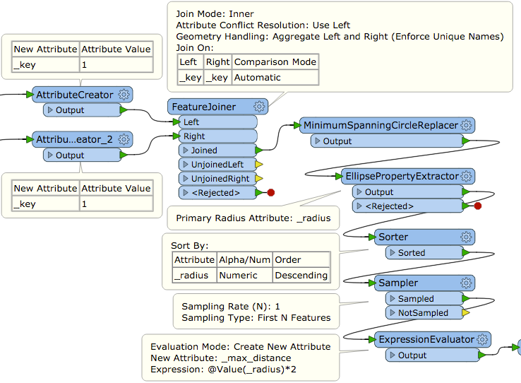
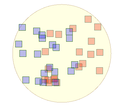
In this figure, the blue polygons and the red polygons represent two polygon datasets. The workflow above selects the largest one in all minimum spanning circles for every pair of red polygon and blue polygon. The diameter of the circle is the maximum distance between the two polygon datasets.
This post is closed to further activity.
It may be an old question, an answered question, an implemented idea, or a notification-only post.
Please check post dates before relying on any information in a question or answer.
For follow-up or related questions, please post a new question or idea.
If there is a genuine update to be made, please contact us and request that the post is reopened.


Login to the community
No account yet? Create an account
An FME Account is required to contribute
LoginEnter your E-mail address. We'll send you an e-mail with instructions to reset your password.