Hello,
For the updating of our topography files I'm trying to cut and merge a lot of .dgn tiles into certain logical areas and output them as dgn.For this task I have the tiles and areas as featureclasses to select where the tiles have to go and clip if needed.
I'm running into problems at the point where I have to pass the dgn files to read into the dgn(v8) reader. At first I tried doing the selction in a separate workspace, writing the result to a txt file and reading them again in a new workspace. I could not get this to work with a scripted python parameter even though I was replicating the exact string used for reading multiple files. It was either reading only the first file or none at all.
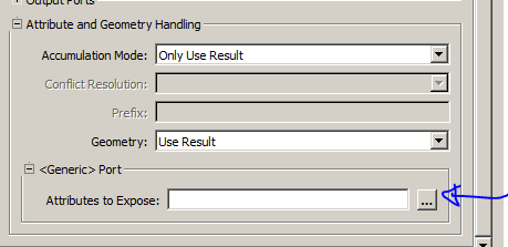
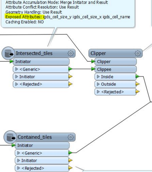
My 2nd attempt was more successful by using the FeatureReader. I merged the selecting and subsequent merging and cutting into a single workspace and it outputs the correct areas. But then I noticed my cells are missing because the FeatureReader is not exposing the IGDS attributes needed to reattach them. It seems I can not expose them using the AttributeExposer either, they're just not available.
I suppose the FeatureReader being categorized as a database transformer was a hint but in it's settings you're perfectly able to select dgn(v8) as a filetype. Am I missing some setting here to get these attributes after all?
The question now is; is there a way to get this working. Either by using my 1st method or (preferably) the 2nd? I've seen some suggestions about using the workspace runner but that is not available in the datainterop extension we're using (GIS version 10.3.1, FME 2015.0 (20150114 - Build 15245 - WIN32))
I'm not sure if I can attach a workspace from the datainterop environment here but I could try to upload the toolbox model if that helps.
Thanks in advance,
Marc


