I am creating a tool to clip a dataset (ESRI FGDB with multiple feature classes) then write the data to a dwg file with the following:
1 - any point feature with a block name in the attributes to the corresponding block in the Template file.
2 - any point feature without a block name in the attributes to be an ACAD point in the layer specified in the attributes
3 - any line feature to be a 3d polyline / 3d line in the layer specified in the attributes.
So far i have been able to achieve each of these separately but cannot get the required output in a single file.
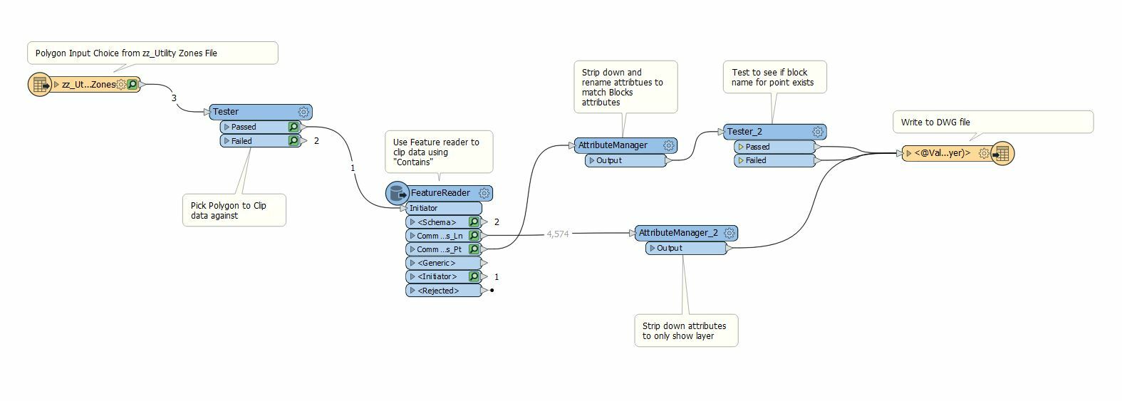
Sample workspace below:
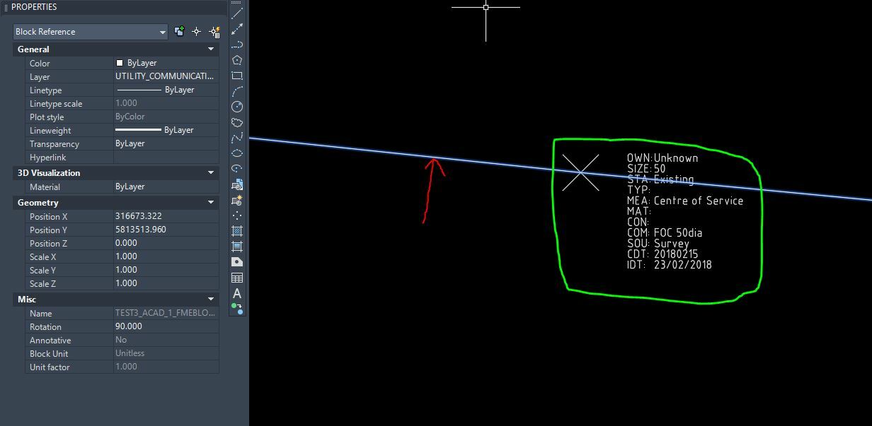
 Below is an example output:
Red arrow - shows the line represented as a block --> this needs to be a 3dpoly or line
Green Square - shows the block attribute for the point with block value in attributes. --> this is correct


