Hello,
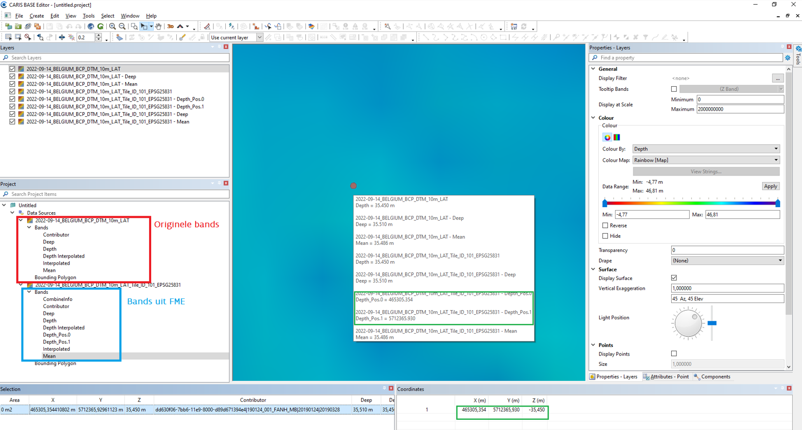
For a FME workflow involving hydrographic CSAR raster files both band and point coordinate information are present in the file. The point coordinate information is the location where the measurement to generate the raster file was taken. This is crucial information for a user.
According to the help page of CSAR raster (CARIS Spatial Archive (CSAR) Raster Quick Facts (safe.com)) this GCP and Z-value information, which to my knowledge is the point measurement location, is not included in the functionality of the CSAR reader or writer. Is there a workaround available in FME to include this point information in the CSAR raster file ? It is important that is saved in the same manner as in the original file. If not,would it be possible to add this functionality in future releases ?
Thank you!