Question

Create one dataset from three


geovision
Contributor
Forum|alt.badge.img+5

I have three datasets containing points which I want to bring down to one complete set.

Dataset A contains most of the points but not very accurate in terms of location

Dataset B contains less points but is more accurate then dataset A

Dataset C contains the least points but is the most accurate of all three sets.


So I am looking to create something like the following:


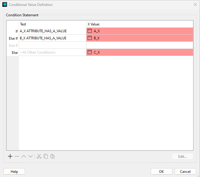
When there are three points (dataset A, B and C) within one meter of each other merge the A and B with the point from C. When there are two points, for example dataset A and C, merge the point from dataset A with the one from C. And so on.. A way of ranking I would say.


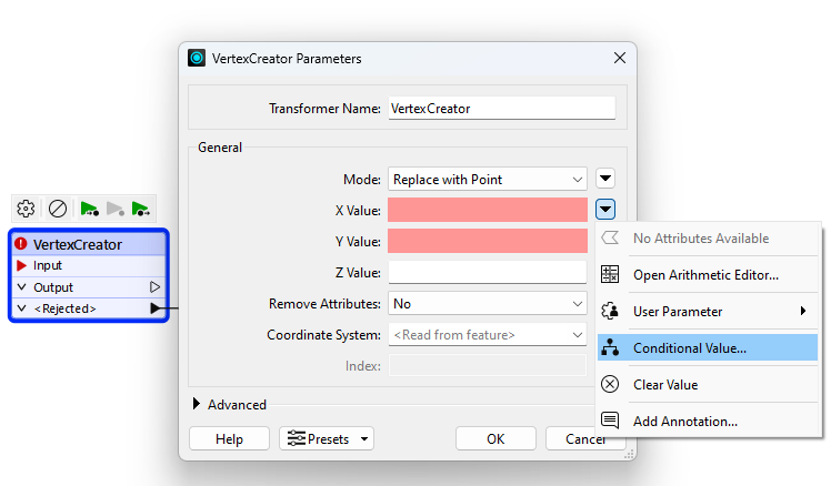
Now I have tried using the NeighborhoodAggregator but I cannot specify which point I want to merge which point. I have also looked at the NeighborFinder but I cannot seem to get that working either. Is it possible to have all three datasets analyzed together? Or do I have to do two at a time?


4 replies

nielsgerrits
VIP
Forum|alt.badge.img+54

I think you are looking for the AnchoredSnapper.


max_h
Supporter
Forum|alt.badge.img+10
  • Supporter
  • April 16, 2025

Can there be multiple points of a/b/c in one meter radius? Because then it could get tricky to get the correct three points


Otherwise you can also extract, expose, rename the coordinates of each point, buffer and dissolve them, remove geometry and then create a vertex according to your ranking (conditional value)


geovision
Contributor
Forum|alt.badge.img+5
  • Author
  • Contributor
  • April 17, 2025
nielsgerrits wrote:

I think you are looking for the AnchoredSnapper.

I used the AnchoredSnapper, what I did was the following. First I used the most accurate dataset (B) as a anchor and the second (A) most accurate as the candidate. Then I used another AnchoredSnapper where I used the most accurate (A) and the unsnapped as anchor. And the least accurate data (C) as the candidate. Then I repeated the previous steps and I think it works! Thanks!


max_h wrote:

Can there be multiple points of a/b/c in one meter radius? Because then it could get tricky to get the correct three points


Otherwise you can also extract, expose, rename the coordinates of each point, buffer and dissolve them, remove geometry and then create a vertex according to your ranking (conditional value)

Can you explain this further for me? What do you mean with rename the coordinates? Like dataset_A_X and dataset_B_Y? And how do I create a vertex? Like if dataset_B_X and Y are present create a vertex? Thanks!


max_h
Supporter
Forum|alt.badge.img+10
  • Supporter
  • April 22, 2025
geovision wrote:

Can you explain this further for me? What do you mean with rename the coordinates? Like dataset_A_X and dataset_B_Y? And how do I create a vertex? Like if dataset_B_X and Y are present create a vertex? Thanks!


Yes, exactly. You can use an coordinate extractor to get the coordinates and then an attribute exposer to show them as attributes, which you then rename according to the dataset, so once you merge/snap/whatever you know for each feature the original A,B,C coordinates.


A VertexCreator can be used to create new points:


But I’m glad the suggested anchoredsnapper worked for you.


Cookie policy

We use cookies to enhance and personalize your experience. If you accept you agree to our full cookie policy. Learn more about our cookies.

 
Cookie settings