

Hi,
I am hoping someone can convert a Geodatabase provided by the United Nations (Unitar & Unosat).
It is published under creative commons 4.0.
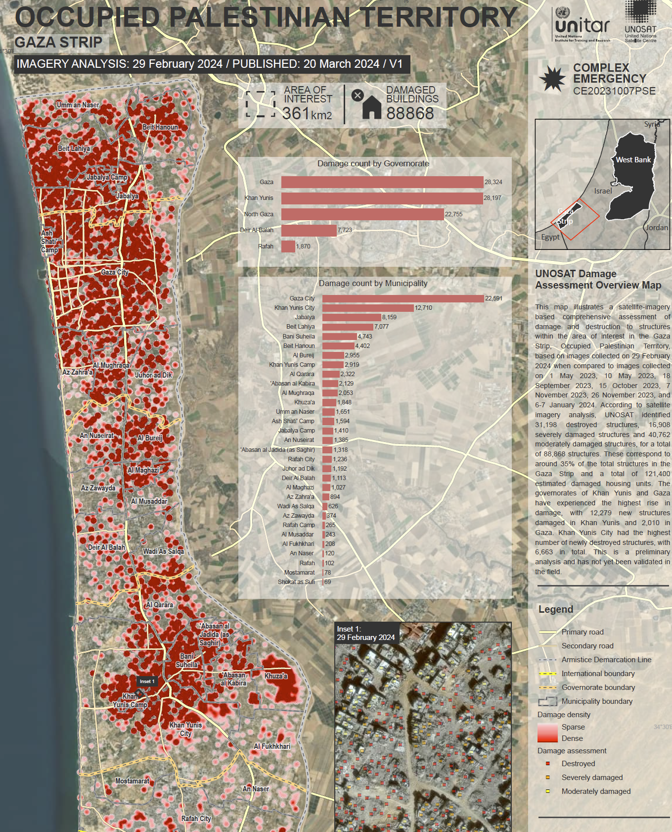
The map shows each building damaged in Gaza.
I do not have any product that opens Geodatabsae files.
I would be appreciative if someone could convert the file into KML so I can open the file in Google Earth.
The zipped geodatabase file is 2.35Mb.
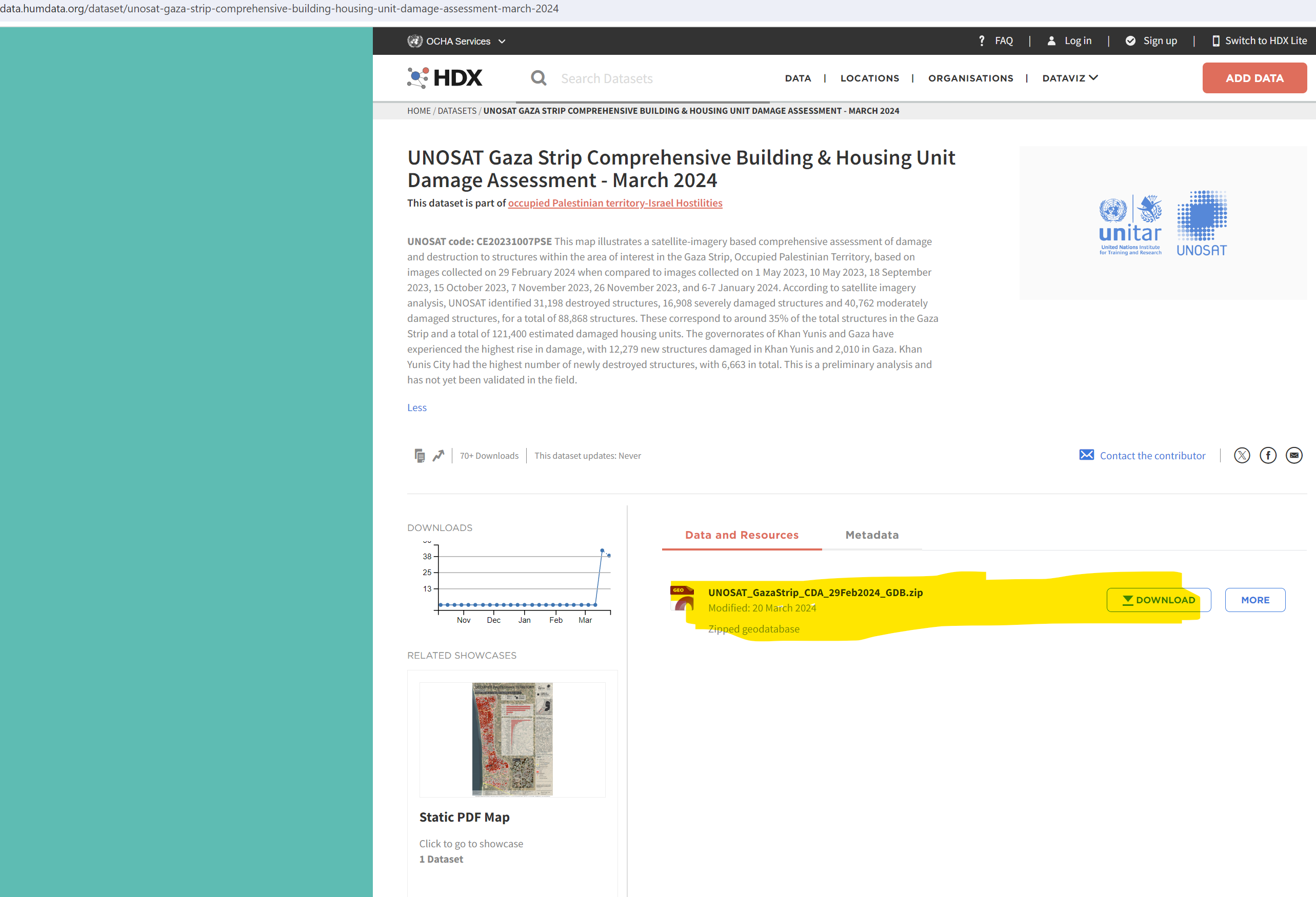
The link is the location of the Geodatase file. https://data.humdata.org/dataset/unosat-gaza-strip-comprehensive-building-housing-unit-damage-assessment-march-2024#
I have also attached two images.
The first image shows the page with the Geodatabase
The second image shows how the UN have used the file to present to the public.
I have submitted a request to UNTAR however they have not responded.
Thanks
Harry Sullivan