Since the unveiling of FME 2017 everybody is talking about the classic / Manhattan and curvy connectors but I think there are quite some cities missing in this list. How would you call the connectors in the workspace below?
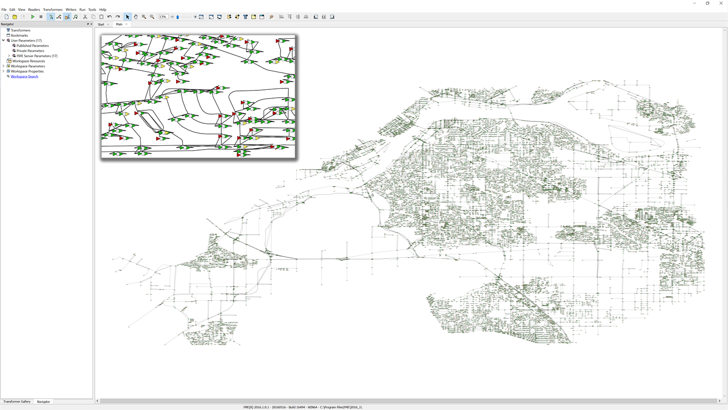
As you can see, you don't need an FME Inspector to visualise data =)

I created a little riddle while waiting for the FME World Tour to start. In this album you will find 10 screenshots of workspaces. For you to find the city they where based upon and the statement hidden in the grey squares.

P.S.1 Fill in both characters and spaces

P.S.2 All cities will be visited by the FME World Tour (Take a look here for a list)


P.S.3 You can validate your answer by clicking on 'Details' in the album.


And now for the question. Do you agree with the hidden statement? (see last picture in album)

UPDATE


I am trying to implement a background color based on georeferenced satellite images (printscreens from Google Earth) but I am not completely able to understand how to scale the annotations correctly.

Is there someone willing to help?

This zip-file contains all files to recreate the image below where you can see that the annotations are overlapping

Wow, that is easily the most ridiculous "workspace" I've ever seen, I love it! :-)

Would be fun to see how you made it!


Wow, that is easily the most ridiculous "workspace" I've ever seen, I love it! :-)

Would be fun to see how you made it!

Thanks!


Of course I will share the workspace that I used to create these maps!


I just have to clean them a bit first because there was some trial-and-error involved ;)


Yes, this is very impressive. Well done! I have to admit I never imagined seeing workspaces as maps. I think we are approaching the signularity.


Yes, this is very impressive. Well done! I have to admit I never imagined seeing workspaces as maps. I think we are approaching the signularity.

Next up: maps as workspaces!

Yes, this is very impressive. Well done! I have to admit I never imagined seeing workspaces as maps. I think we are approaching the signularity.

Thanks!


Tomorrow I will provide you the workspace. I have to provide some more comments so others can improve it.


Suggestion: Add functionality to add bookmarks in blue for water, green for forest?


Who is in for this challenge?


@david_r @daleatsafe As promised the workspace used to create these maps:


createmapsinworkbench-jeroenstiers.zip


And just one other example that required a bit of manual tuning.


Have fun and please keep me posted about your creations!

Well done i (or ! ;-))


Nonono! We where doing so well in automating our computer/GIS/IT-related tasks by switching from custom scripts/batches/multiple software/manual work/file moving etcetc and replacing that with FME doing everything automatically. And now we are back at wasting time instead :)

PS: Is it possible to play a video by having the boxes "move" by doing undo etc... that would be great :)

I have not found a way to refresh workbench to reload the .Fmw-file. Therefore I think this is not possible. But maybe @daleatsafe knows a way?


I have not found a way to refresh workbench to reload the .Fmw-file. Therefore I think this is not possible. But maybe @daleatsafe knows a way?


Can't think of a way either. I was thinking that the undo stack could be tricked into providing animation, but that is not saved in a workspace.


Thanks for participating everybody!


Reply