I am using FME(R) 2023.1.1.1 (20231011 - Build 23636 - WIN64) - FME Forms.
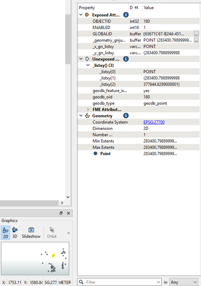
When running a workflow with the Data Inspector, from a file geodatabase with the SpatialRelator, the workbench appears to change coordinates on the fly. The dataset is in British National Grid (EPSG27700) with an expected data format of XXXXXX.XXX YYYYYY.YYY (depending on decimal places specified, ESRI being 3 decimal places resolution in metres). An example is 283400.7988999998 377644.82890000001.
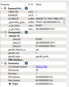
However, inspecting the output, within the inspector attribute table and the feature information windows, this is replaced by an arbitrary grid XX.XXX, YY.YYY. An example is 66.069000000013411 97.342000000017881. (These examples are different points). This doesn’t appear to be any projection or coordinate system with which I am familiar in this area and seems to be an arbitrary grid.
Finally, when I click a point in the Inspector visual preview window, the coordinate system restores itself back to EPSG27700. This solves the problem, and I am confident the data is unchanged (after checking in ArcGIS Pro 3.1) but it is very strange. I don’t think I have encountered this issue before.
It may, or may not, be related to the use of the SpatialRelator in the workflow.