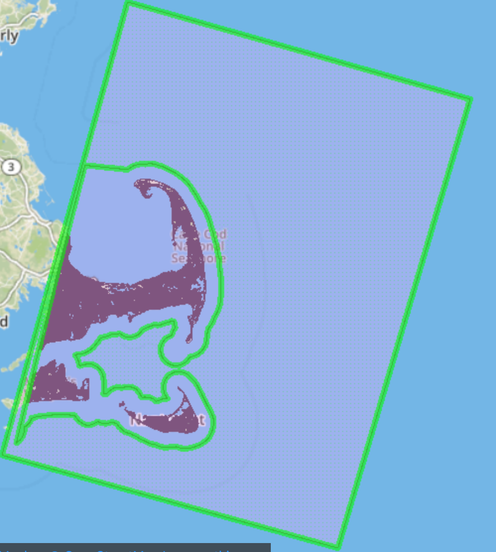

My workflow is simple. I use shp files generated from Land Cover metadata to clip the ERDAS Imagine file and convert it to polygons. Each shapefile contains a polygon as a clipper.
As instructed by the forum discussion,
1) In Workspace1,
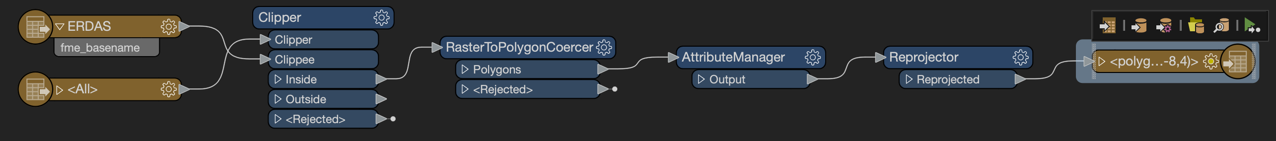
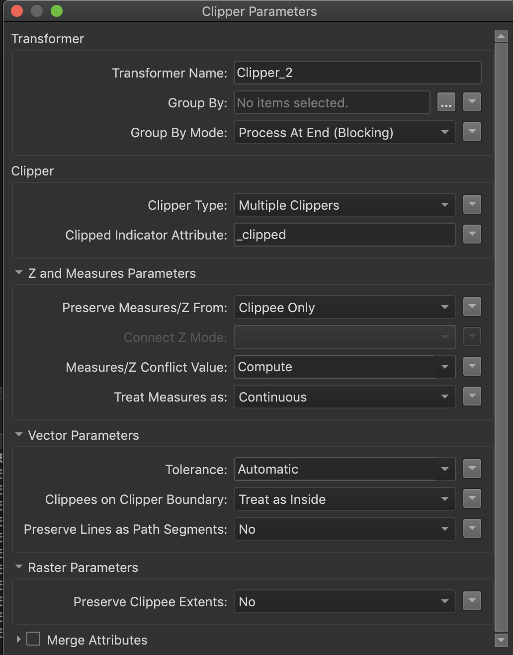
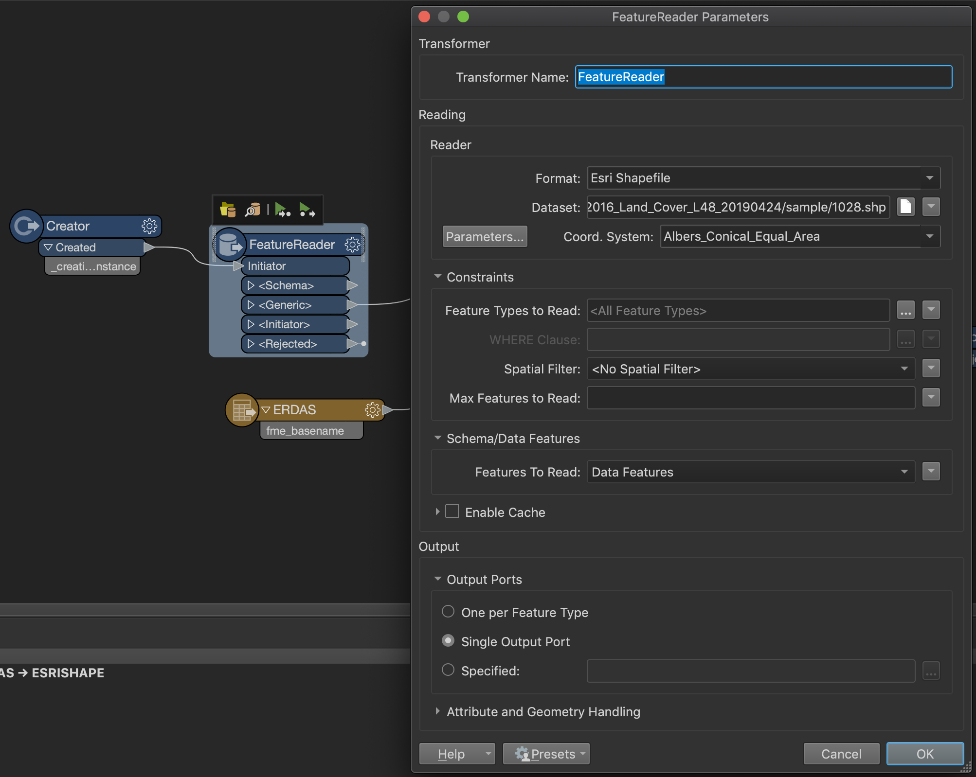
- I set the workflow options as "Single Merged Feature Type" and I chose one of the shape files in my sample data folder (which contains three sample shp files).
- The output file is named based on the input shapefile name.
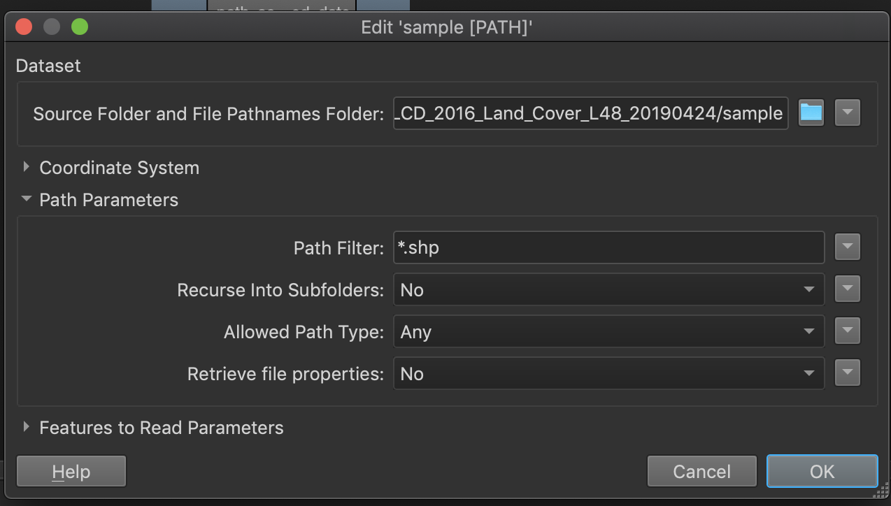
2) In Workspace2 - Path Reader setting, I set the dataset folder to sample folder and only read in shp files.
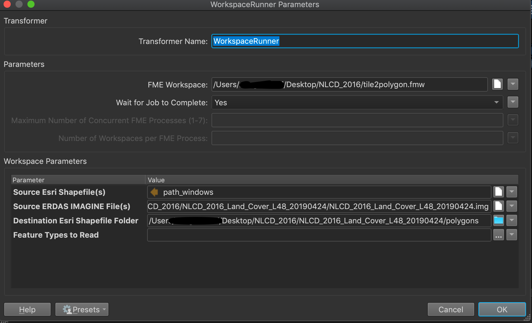
3) In Workspace2 WorkspaceRunner setting,
- pointed the FME Workspace to Workspace1 - tile2polygon.fmw
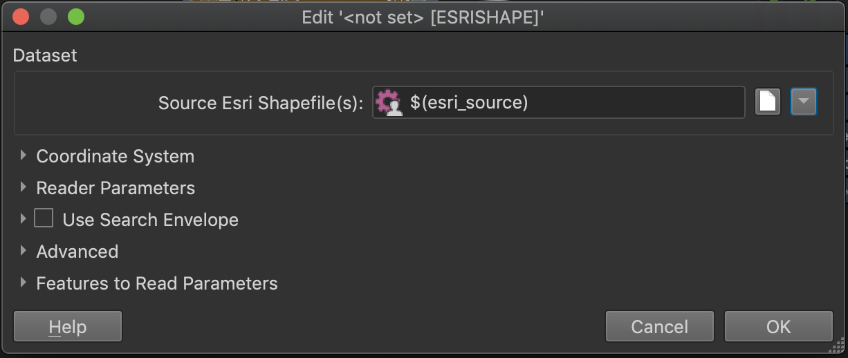
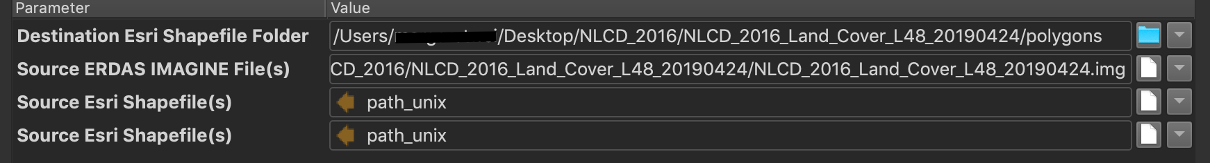
- set the shapefile to path_windows
- set the erdas img file to the corresponding img file
- set the destination folder to an empty folder
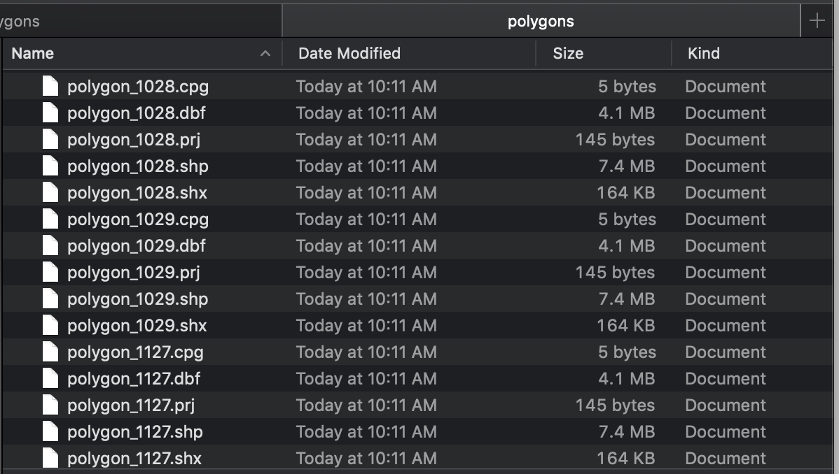
I run the workspace runner without any issue reported and as I checked the destination folder, there are three files with name corresponding to the input shapefile.
However, all three shape files have the same size and records, i.e, same result. And the result is based on what I chose as a clipper in Workspace1. I doubled checked the three input shapefiles to make sure they have different geometries.
I am wondering if anyone had a similar issue or can help me figure out what is wrong with my configuration.
Thank you!


 As for Workspace2, I believe I should not change any parameters as I removed the initial reader so the source ESRI shapefiles should still be the same "path_windows".