Hello,
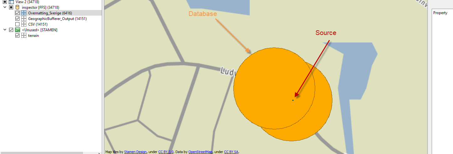
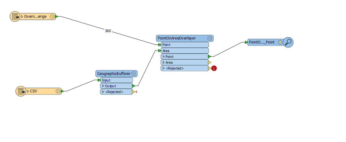
I want to use Point on area overlay transformer but it does not work and I don't know why. As You can see here some points are overlaying the buffer I created but output is collapsing.
Hello,
I want to use Point on area overlay transformer but it does not work and I don't know why. As You can see here some points are overlaying the buffer I created but output is collapsing.
What is the error message in the FME log window?
The GeographicBufferer expects an input geometry. If you connect an Inspector to the "CSV" input feature, are you seeing the geometries? If not, you may have to use a VertexCreator before the GeographicBufferer.
I can see geometry in the inspector as you can see in the screen attached in the previous comment
You could insert a Tester on the CSV features to check that the X/Y values are within the expected range.
But I still do not understand it. I can locate them on the map in the inspector and after I create a buffer I can see they overlay with the source points which can be seen here. Do you know what is the problem then?
My guess is that there's something wrong in the CSV data. Consider sending all the CSV features to the Inspector and carefully check all the X/Y values (not the geometries, but the attribute values used to create the geometry). I'm guessing you have at least one invalid or empty value somewhere.
You seem to have 1 rejected point geometry.
Try setting the Rejected object handling to "Continue".
You can find this setting in the Navigator panel under Translation.
Thanks guys for help it turned out to be the vertexcreators that did the trick. The thing is that I do not understand that becuase I set up the X and Y coordinates when I added the readers which as I mentioned can be seen on the scan from the inspector. Nevertheless I think I have an positive outcome.
If you define the coordinate columns when creating the CSV reader, FME will try it's best to convert the X/Y values to point geometries. However, if it fails on one or several features, those features will still be output, but with a NULL geometry.
Since the PointOnAreaOverlayer doesn't accept NULL geometries, they exit through the <Rejected> port, and therefore terminating your translation.
When you use the VertexCreator as you do in your screenshot here, you're effectively filtering away those features where the X/Y values are invalid, and as a consequence you no longer get any errors on the PointOnAreaOverlayer.
I hope that makes sense.
It all makes sense now. Thanks for such an elaborated answer.