Question

What is "surface tolerance"? - Contour generator

  • May 22, 2018
  • 2 replies
  • 112 views

Forum|alt.badge.img

Could anyone please explain in simple language what "surface tolerance" is regarding the transformer "Contour generator". What units are used? If I specify a surface tolerance of 1, which coordinates are filtered out?
 

This post is closed to further activity.
It may be an old question, an answered question, an implemented idea, or a notification-only post.
Please check post dates before relying on any information in a question or answer.
For follow-up or related questions, please post a new question or idea.
If there is a genuine update to be made, please contact us and request that the post is reopened.

2 replies

redgeographics
Celebrity
Forum|alt.badge.img+60
  • Celebrity
  • 3703 replies
  • May 22, 2018

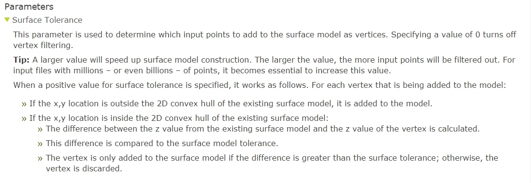
The way I understand it that tolerance is the minimum z-difference (in whatever units your data is in) needed for a point to be added to the surface model.


  • 15 replies
  • May 22, 2018

The below example may give you clear answer

  1. For example, if the elevation values in your input raster are in feet, but you want the contours to be generated based on units of meters, set the z-factor to 0.3048 (since 1 foot = 0.3048 meter).
  2. For another example, consider an input raster in WGS_84 geographic coordinates and elevation units of meters for which you want to generate contour lines every 100 feet with a base of 50 feet (so the contours will be 50 ft, 150 ft, 250 ft, and so on). To do this, set the contour_interval to 100, the base_contour to 50, and the z_factor to 3.2808 (since 1 meter = 3.2808 feet).