Solved

What I am doing wrong? Bufferer tool error

  • April 8, 2016
  • 4 replies
  • 107 views

Hello people,

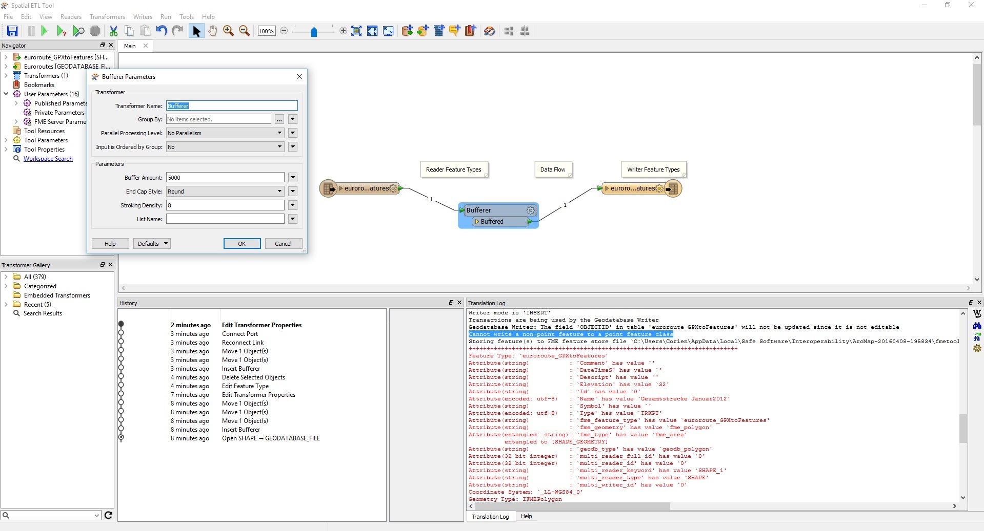
I am new to GIS and FME. For my study we are using ArcMap. Ik have an shapefile and now I need to create a 5000 meter buffer around the shapefile. Therefore I must use the Bufferertool from FME. The result wil be written to a file geodatabase.

Anytime I run the spatial ETL tool from FME I get an error and see no buffer of 5000m around the points of the shapefile.

I have ad some screenshot. Does anybody know what I am doing wrong in my setup?

Thanks in advance.

Tijs

Best answer by erik_jan

The coordinate system of your source data is in lat / long (degrees).

The Bufferer will use the same units as your data, so you create a buffer of 5000 degrees, which is way out of the galaxy.

You need to use the GeographicBufferer or need to reproject (Reprojector) your data before creating the buffer.

This post is closed to further activity.
It may be an old question, an answered question, an implemented idea, or a notification-only post.
Please check post dates before relying on any information in a question or answer.
For follow-up or related questions, please post a new question or idea.
If there is a genuine update to be made, please contact us and request that the post is reopened.

4 replies

erik_jan
Contributor
Forum|alt.badge.img+22
  • Contributor
  • 2179 replies
  • Best Answer
  • April 8, 2016

The coordinate system of your source data is in lat / long (degrees).

The Bufferer will use the same units as your data, so you create a buffer of 5000 degrees, which is way out of the galaxy.

You need to use the GeographicBufferer or need to reproject (Reprojector) your data before creating the buffer.


mark2atsafe
Safer
Forum|alt.badge.img+56
  • Safer
  • 2554 replies
  • April 8, 2016

Also, click on the cogwheel button on the right-hand object (we'd call it a Writer Feature Type) and check the parameters to ensure it is set to a polygon geometry.

If you translate from a points dataset then, by default, the output will expect points. If you change them to polygons with the Bufferer then the data will probably be thrown away when FME tries to write it. So make sure the output is set to write a polygon geometry.


  • Author
  • 1 reply
  • April 11, 2016

Hello people,

It works! Thank you very much al for your advice!


  • 1 reply
  • September 24, 2018

Hello people,

It works! Thank you very much al for your advice!

Hi


Please show me how it , in answering your question?


a workflow diagram would go a long way.