Hello,

I am struggling with the use of a WMS reader within my workbench. I would like to use the outcome of the WMS reader as a shapefile and use it within a Clipper transfomer.

But the outcome of the WMS reader is not (yet) suitable for shapefile purposes, as it is a raster.

I tried the transformer RasterToPolygonCoercer, but it results in a lot of polygons instead of only one polygon (matching the national border of the Netherlands).

Should I use another transformer? Or is it possible to read the WMS with different settings?


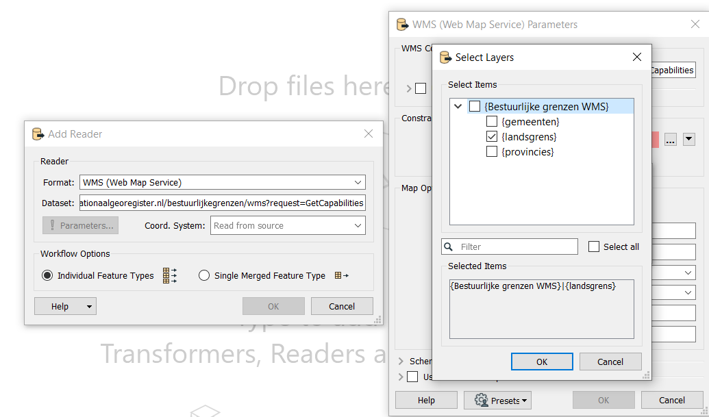
For the WMS reader, I use the following URL:

https://geodata.nationaalgeoregister.nl/bestuurlijkegrenzen/wms?request=GetCapabilities

Within 'Parameters...' I select under 'Layers' the layer 'landsgrens'. This is the layer where I am interested in.


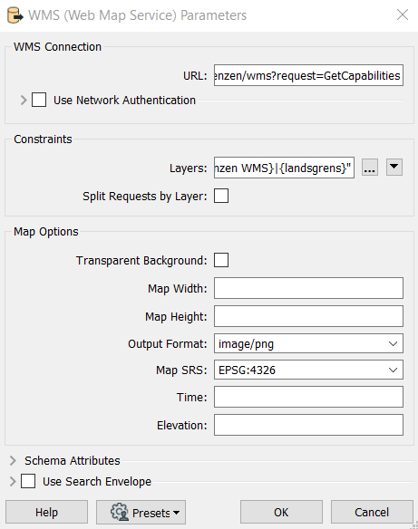
Furthermore, I used the default settings:
 

Hope anyone can help me getting the national border as a shapefile.


Thanks,

Eva

While it's possible to interpret a raster and convert it to a vector feature, it's inherently going to be a lossy procedure with lots of possibility for error.

What you probably want is to use the WFS endpoint rather than the WMS one, as it returns proper vector features in stead of rasters: https://geodata.nationaalgeoregister.nl/bestuurlijkegrenzen/wfs?request=GetCapabilities

You can then write the polygon output directly to the shape file without any further transformers.

Ah yes, that's what I needed. Thank you! I was not yet familiar with the difference between WMS and WFS :-)


Reply