Solved

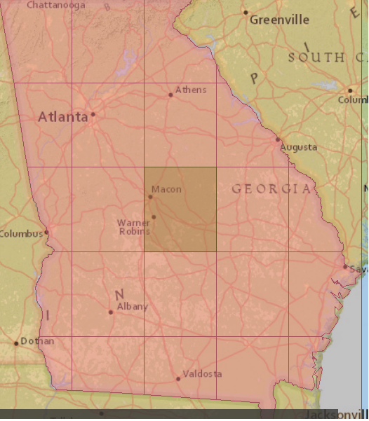
Use tiler on a state boundary to build equal squares using map scale to calculate my width/height parameters for the Tiler

  • August 29, 2019
  • 3 replies
  • 27 views

salvaleonrp
Enthusiast
Forum|alt.badge.img+20

I have a state boundary and I want to use a map scale as a parameter to calculate the Tile width and Tile height (ground units) as attributes for the Tiler.

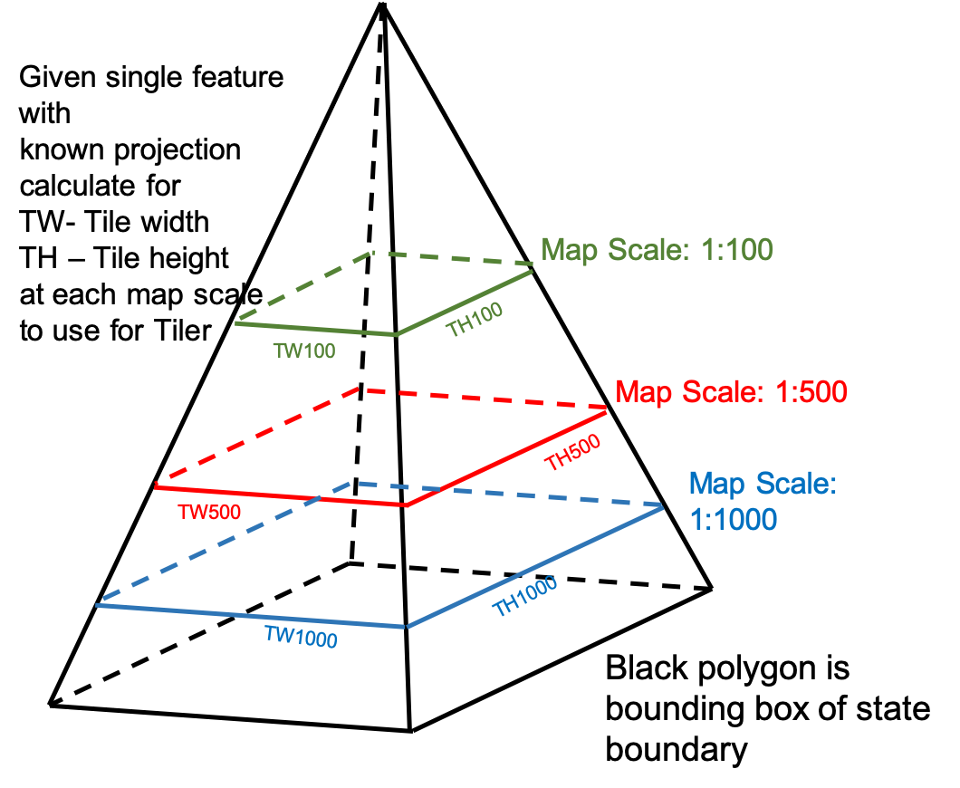
Given a coordinate system, how do I calculate that width and height of that bounding box at a scale of 1:100 using an Expression Evaluator? Then do it again for the next scales 1:500, 1:1000, etc.
 

Best answer by virtualcitymatt

BoundingBoxReplacer to get the box of the original unscaled state boundary > Scaler to scale the box to the arrpopriate scale > BoundsExtractor to get corners > ExpressionEvaluator to calculate diff bewtween max and mins.

This post is closed to further activity.
It may be an old question, an answered question, an implemented idea, or a notification-only post.
Please check post dates before relying on any information in a question or answer.
For follow-up or related questions, please post a new question or idea.
If there is a genuine update to be made, please contact us and request that the post is reopened.

3 replies

virtualcitymatt
Celebrity
Forum|alt.badge.img+47
  • Celebrity
  • 2000 replies
  • Best Answer
  • August 29, 2019

BoundingBoxReplacer to get the box of the original unscaled state boundary > Scaler to scale the box to the arrpopriate scale > BoundsExtractor to get corners > ExpressionEvaluator to calculate diff bewtween max and mins.


salvaleonrp
Enthusiast
Forum|alt.badge.img+20
  • Author
  • Enthusiast
  • 154 replies
  • August 30, 2019

My premise was wrong but the solution is right. I need the relative spatial extent of the data and not really view extent. I can't have a map or display scale if I don't pick my map or display size. The number that I type in the scaler parameter became a number to make my tiles smaller or bigger.

I'm sharing my solution in case some else may have a need for it. The default Scaler parameter is set to 1 right now.

Thanks.

pyramid_tiler.fmwt


virtualcitymatt
Celebrity
Forum|alt.badge.img+47
  • Celebrity
  • 2000 replies
  • September 2, 2019

My premise was wrong but the solution is right. I need the relative spatial extent of the data and not really view extent. I can't have a map or display scale if I don't pick my map or display size. The number that I type in the scaler parameter became a number to make my tiles smaller or bigger.

I'm sharing my solution in case some else may have a need for it. The default Scaler parameter is set to 1 right now.

Thanks.

pyramid_tiler.fmwt


Thanks for sharing!