


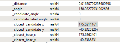
I have a pair of longitude latitude coordinates that I’m trying to measure the distance between in KM
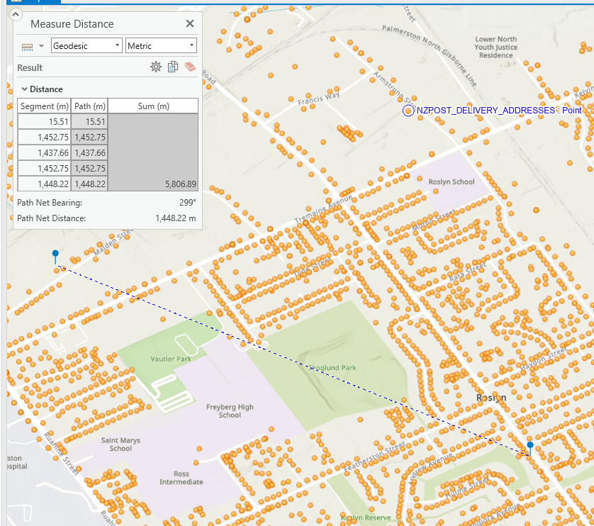
If I cross-reference this “distance” result in ArcGIS Pro, I get approximately 1.44km
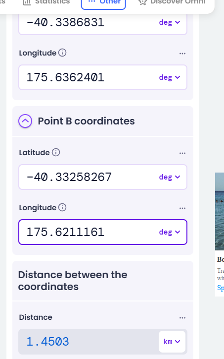
This is also roughly the same result if I use a online calculator;
My question, is how does the result 0.01630799258600798 translate to 1.44km? is there something I’m missing??


