Hello everyone, happy monday to you all,
I have a dataset of points on a road network which I am trying to assign to groups of max 300 points. There are two attributes which must be the same for all the points in a certain group.
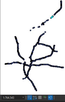
Also, to make the work of our editing team easier, the groups should be sorted by location. For this I am using the SpatialSorter (Hilbert sort in 2D). I am however getting some unexpected results. In the screenshot below I have selected all points in group 1100, also note the scale below to get a rough idea of this dataset:
 These points seem grouped correctly but they are not all grouped together.
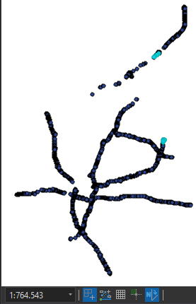
These are the points in group 1101:
 There is a large gap between these points (about 25km).
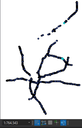
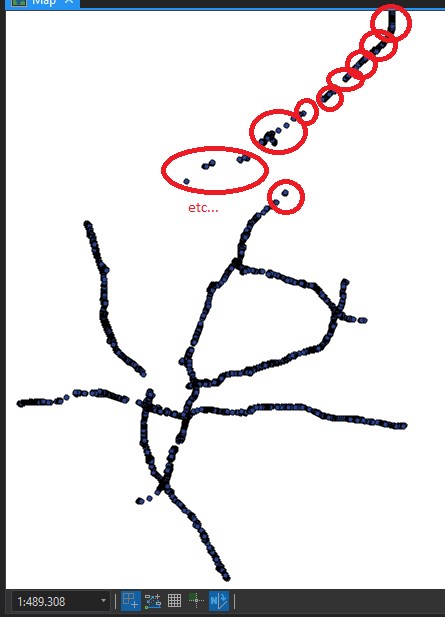
Group 1102 (and a lot more groups for that matter) show the same gap: I guess there is some spatial relationship between these points, since they seem to be on roughly the same vertical axis, but it's not as accurate as I would have expected. Any explanation for this? This is what I would have expected, give or take:

I used to calculate the groups using a PythonCaller, but for testing purposes I have omitted the PythonCaller and I still get the same results: The workflow above does not abide to my constraints of the two attributes that must be the same, but my current focus is on getting this SpatialSorter to match my expectations.
Any guesses as to why the SpatialSorter is behaving like this? Or maybe alternative workflows that get the same result?
Kind regards,
Joep


