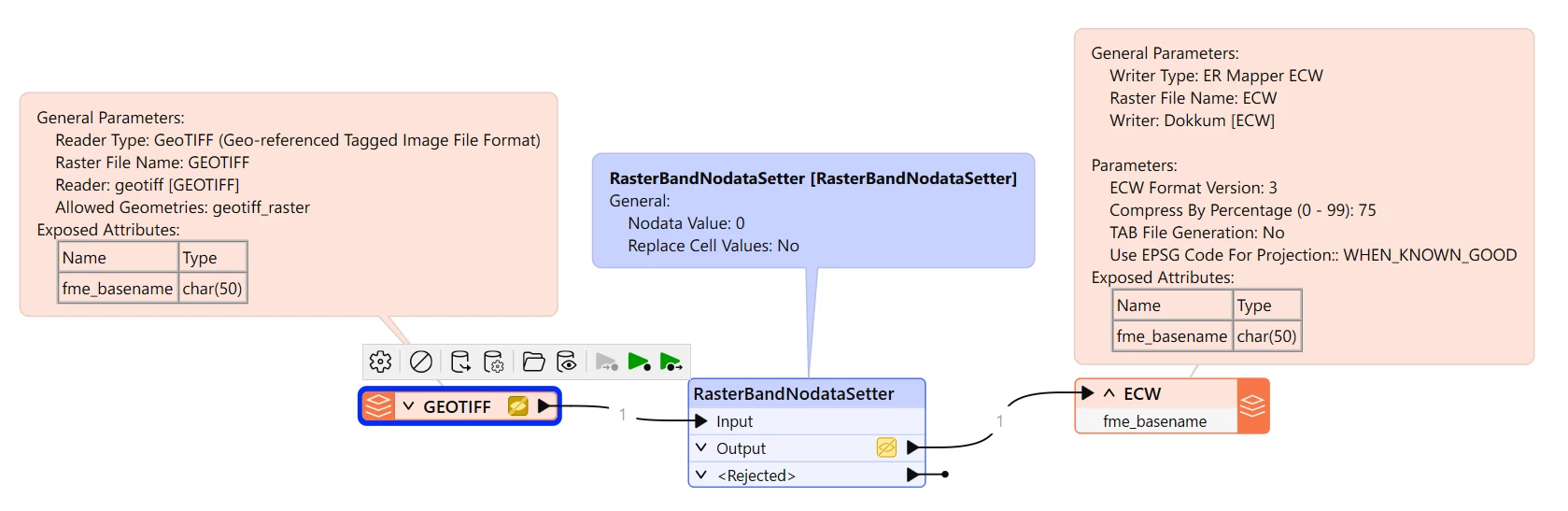
I want to transform a geotiff to an ecw while removing the nodata. The geotiff has just one band (band 0: Gray8). I do not have a clipper, so I think cannot use option 2 or 3 mentioned here, but only the first: use a rasterbandnodatasetter.
So I used a rasterbandnodatasetter to set 0 as nodata, but when writing to the ECW this is not retained and still a black border is shown around the georeferenced image.
What should I do to remove it definitely?