Question

Snapping polygon to polygon from local CRS to EPSG CRS

  • June 9, 2019
  • 1 reply
  • 16 views

lazarlubomir
Contributor
Forum|alt.badge.img+10

Hello everybody,

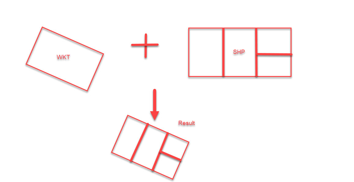
please, is there any way, how to snap polygon and its features (floorplan) in shapefile from local coordinate system to polygon in EPSG coordinate system written in WKT? I have tried Affiner, it is way, but do You have another idea?

Thanks a lot!

Lubo

This post is closed to further activity.
It may be an old question, an answered question, an implemented idea, or a notification-only post.
Please check post dates before relying on any information in a question or answer.
For follow-up or related questions, please post a new question or idea.
If there is a genuine update to be made, please contact us and request that the post is reopened.

1 reply

takashi
Celebrity
  • 7843 replies
  • June 10, 2019

If you could get the coordinates of four corners for each data extents, the AffineWarper and/or the RubberSheeter could also be used.