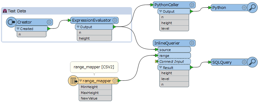
Essentially
MinHeight, MaxHeight, NewValue
0,10,Level1
10,20, Level2
20,30,Level3
such that a feature with a height of 14.7 would map to Level2.
The mapping file is an external csv maintained by someone who has no knowledge of FME, and get's updated on avergae every 2 months.