Hi Experts
Need your support and Guidance.
I was having p scanned PDF and exported a page of the map which was of 1984 and I need to extract the Points with location details with size of each point size so that i can differentiate them based on that.
Main challenge is how to georefence it and I have vector file for the province and Extent and 30 M grid i was able to secure that but How can i proceed to georeference and get the details.
Kindly Guide and support.
I have attached the Image file with GDB of it
https://drive.google.com/file/d/1SZXkbyDlMxL_cE0FPsiHKuuECl7k6HrW/view?usp=sharing
Thanks

Solved
Scan PDF exported non spatial -Image file - Georeerence and extract the points with the size of the colour available

 +9
+9- Supporter
- 40 replies
Best answer by danilo_fme
Hi
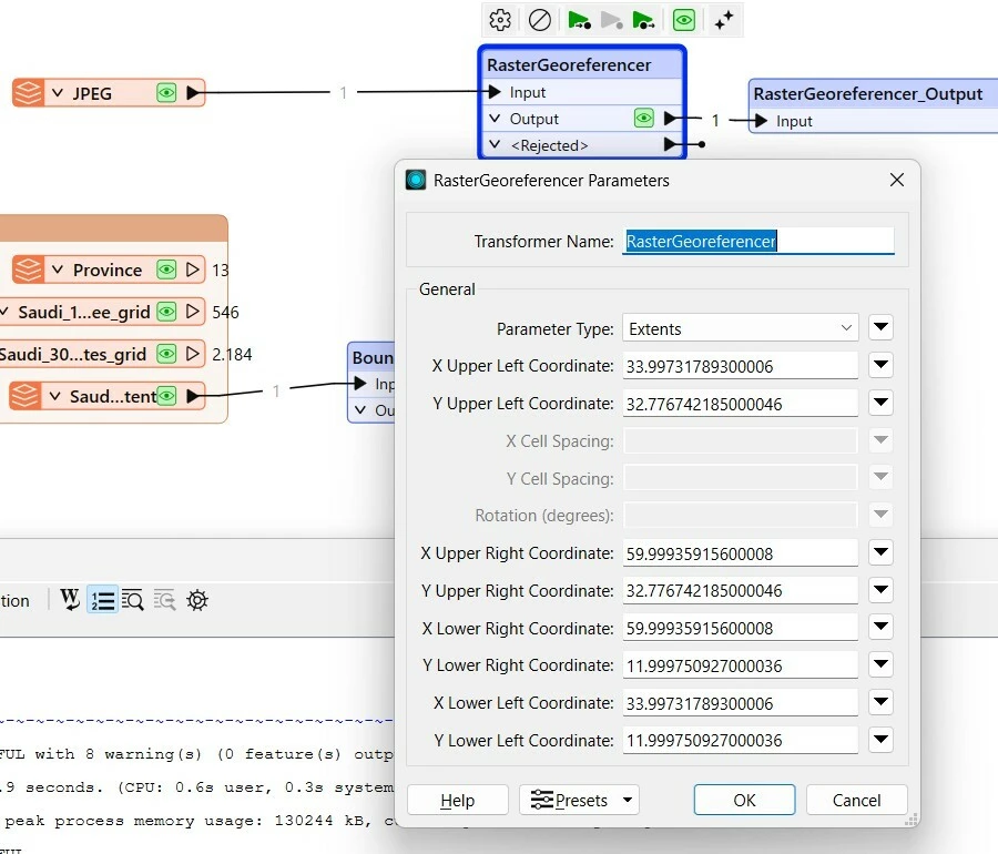
I used the transformer RasterGeoreferencer in your source JPG:
Thanks in Advance,
Danilo