
Hi Experts
Need your support and Guidance.
I was having p scanned PDF and exported a page of the map which was of 1984 and I need to extract the Points with location details with size of each point size so that i can differentiate them based on that.
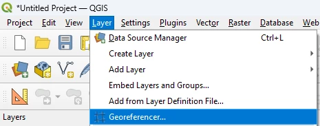
Main challenge is how to georefence it and I have vector file for the province and Extent and 30 M grid i was able to secure that but How can i proceed to georeference and get the details.
Kindly Guide and support.
I have attached the Image file with GDB of it
https://drive.google.com/file/d/1SZXkbyDlMxL_cE0FPsiHKuuECl7k6HrW/view?usp=sharing
Thanks

Solved
Scan PDF exported non spatial -Image file - Georeerence and extract the points with the size of the colour available
 +10
+10- Supporter
Best answer by nielsgerrits
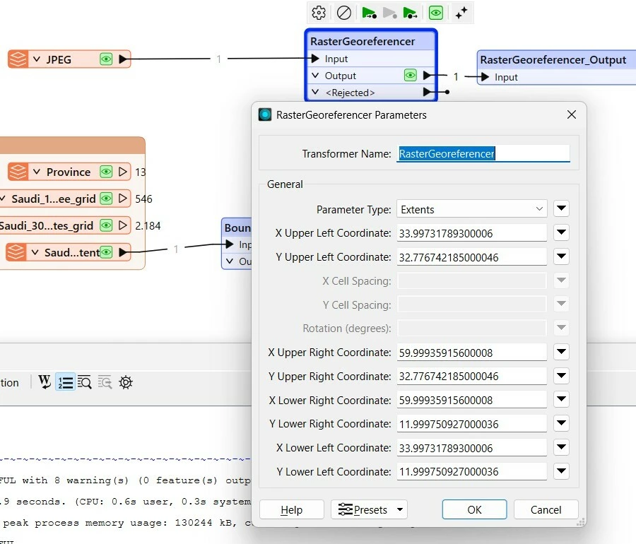
Then do one print manually, find the coordinates of the corners and then use the RasterGeoreferencer as
This post is closed to further activity.
It may be an old question, an answered question, an implemented idea, or a notification-only post.
Please check post dates before relying on any information in a question or answer.
For follow-up or related questions, please post a new question or idea.
If there is a genuine update to be made, please contact us and request that the post is reopened.


Login to the community
No account yet? Create an account
An FME Account is required to contribute
LoginEnter your E-mail address. We'll send you an e-mail with instructions to reset your password.