
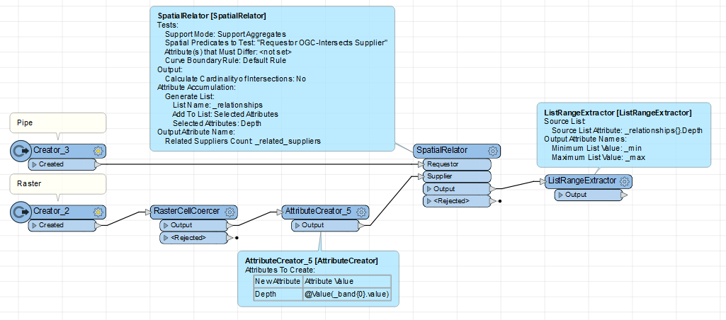
I have a raster with downpour data (with water depth in different areas) and a vector layer with sewer pipes data. I want to know the maximum water depth of a sewer pipe.

I have found an ArcGIS Analysis tool called Sample, is there anything like that in FME?

https://pro.arcgis.com/en/pro-app/latest/tool-reference/spatial-analyst/sample.htm

Quick method is to use a Snipper to take the pipe endpoint (vertex -1), and get the depth of the raster there with the PointOnRasterValueExtractor.

Complete method could be something like: Convert raster to polygon cells, intersect that with the pipes, creating list of every depth the pipe touches, then get the max value in that list. image


Reply