Solved

Reprojector

  • November 12, 2021
  • 3 replies
  • 19 views

arash_hokm
Contributor
Forum|alt.badge.img+8

Hi FME Community,

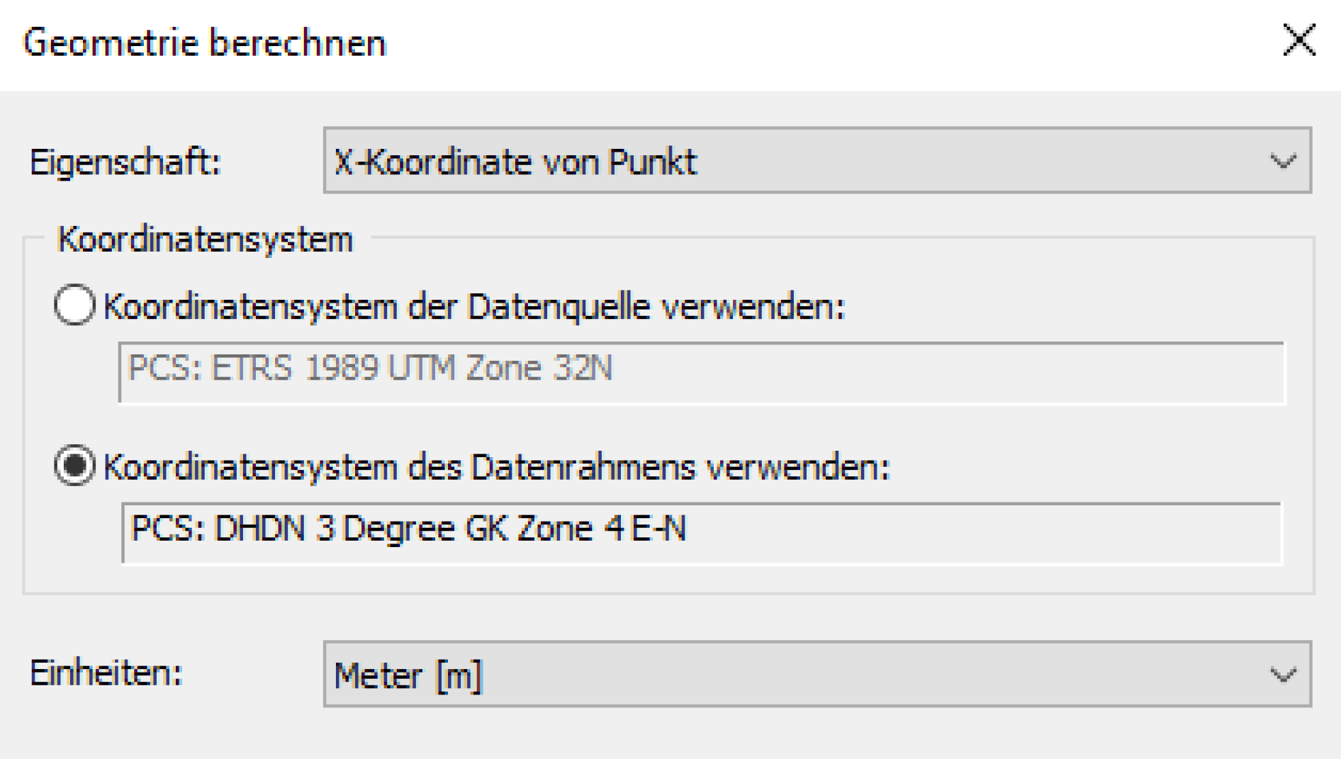
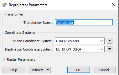
I would like to reproject my file into another coordinate system. I am looking for correct coordinate system. ArcMap gives me a correct result. FME gives me wrong coordinate after the reprojector.

the pictures show which coordinate systems I used in FME and ArcMap. In addition, my file belongs to Germany.

Thanks a lot in advance


ArcMapFME 


Best answer by nielsgerrits

As an alternative you can use the EsriReprojector to use the Esri reprojection library to reproduce an Esri reprojection.

This post is closed to further activity.
It may be an old question, an answered question, an implemented idea, or a notification-only post.
Please check post dates before relying on any information in a question or answer.
For follow-up or related questions, please post a new question or idea.
If there is a genuine update to be made, please contact us and request that the post is reopened.

3 replies

nielsgerrits
VIP
Forum|alt.badge.img+60
  • 2938 replies
  • Best Answer
  • November 12, 2021

As an alternative you can use the EsriReprojector to use the Esri reprojection library to reproduce an Esri reprojection.


tomfriedl
Contributor
Forum|alt.badge.img+13
  • Contributor
  • 177 replies
  • November 12, 2021

The coordinate system ETRS in Germany (Country NRW) has the EPSG-Code 25832.


arash_hokm
Contributor
Forum|alt.badge.img+8
  • Author
  • Contributor
  • 44 replies
  • November 12, 2021

As an alternative you can use the EsriReprojector to use the Esri reprojection library to reproduce an Esri reprojection.

@nielsgerrits​ very good. it worked. Thank you