Solved

Oracle Spatial Writer not creating geometry

  • July 27, 2021
  • 2 replies
  • 73 views

chris_acc
Contributor
Forum|alt.badge.img+5

Hi,

I am trying to read data Oracle non spatial data from a View and create an output in Oracle Spatial.

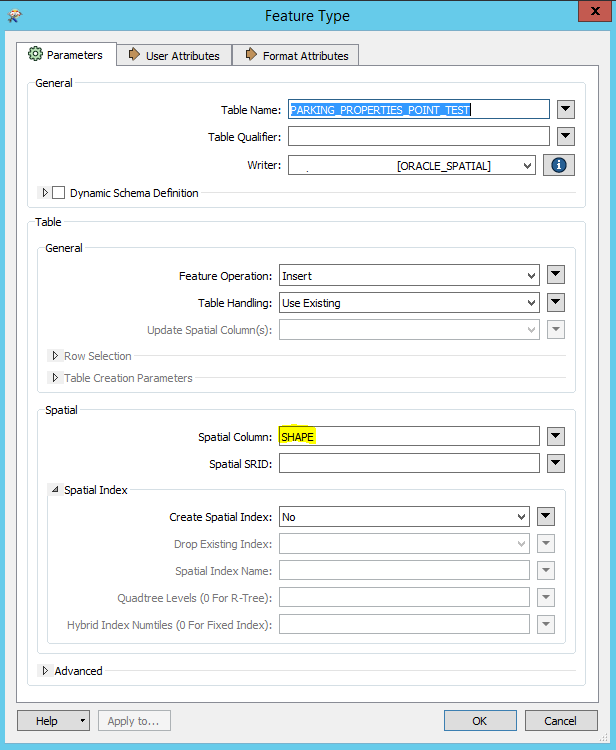
Although the process writes to the Oracle Spatial table and you can view the attribute data OK the data does not seem to be spatial and I can't see any data on a map.


FME_Parking_Oracle_Issue
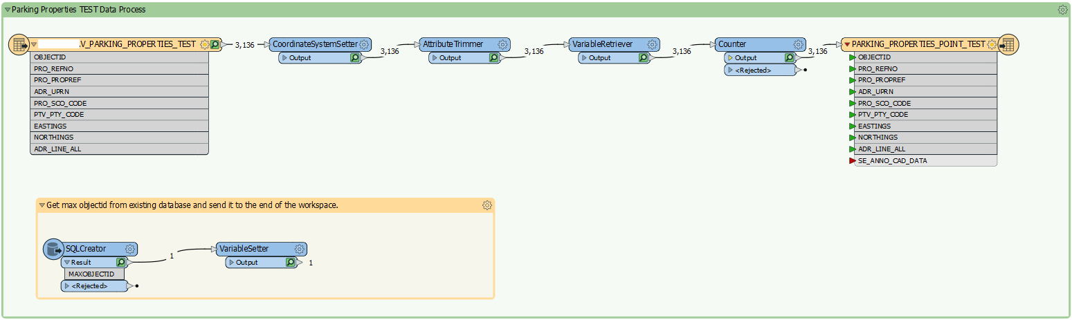
I have learned through passed experience that the Spatial Column must be

changed from GEOM to SHAPE

FME_Parking_Oracle_Issue_2
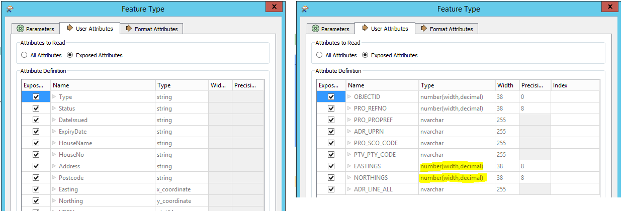
Not sure if this is because i can't set the Eastings and Northings in the Reader to Types x_coordinate and y-coordinate?

You can set in a CSV Reader but not Oracle? (if this is the issue)

FME_Parking_Oracle_Issue_3 


Thanks

Best answer by ebygomm

I think points are probably not generated automatically from the Eastings and northings column with the Oracle non spatial reader as they are with some other formats. You can use a vertex creator to use the values to create points

This post is closed to further activity.
It may be an old question, an answered question, an implemented idea, or a notification-only post.
Please check post dates before relying on any information in a question or answer.
For follow-up or related questions, please post a new question or idea.
If there is a genuine update to be made, please contact us and request that the post is reopened.

2 replies

ebygomm
Influencer
Forum|alt.badge.img+44
  • Influencer
  • 3427 replies
  • Best Answer
  • July 27, 2021

I think points are probably not generated automatically from the Eastings and northings column with the Oracle non spatial reader as they are with some other formats. You can use a vertex creator to use the values to create points


chris_acc
Contributor
Forum|alt.badge.img+5
  • Author
  • Contributor
  • 29 replies
  • July 27, 2021

I think points are probably not generated automatically from the Eastings and northings column with the Oracle non spatial reader as they are with some other formats. You can use a vertex creator to use the values to create points

Perfect, thanks @ebygomm​ that worked 😉