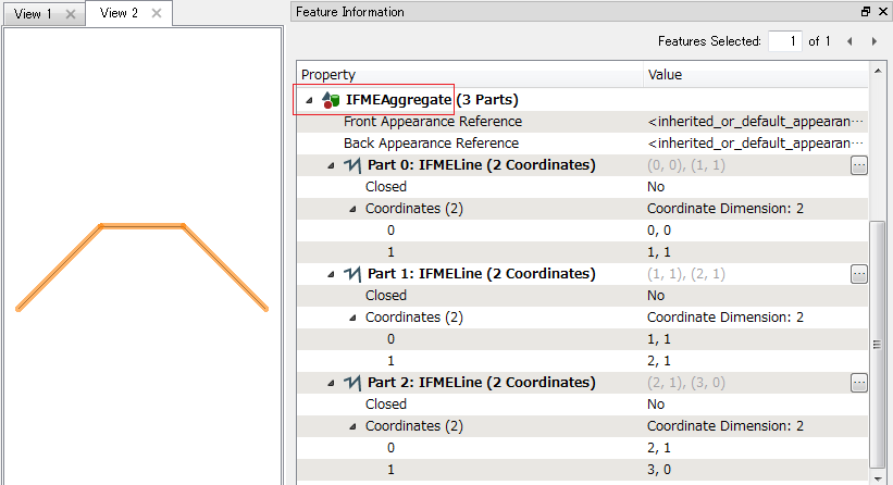
Folks,
This is a question of cleanup and an answer here will decide what technology is best for dealing with this issue.
I have a number of Mapinfo tables that should contain typical simple multi-SEGMENT polylines.
However due to some sort of conversion or creation error some of the objects are mutli-SECTION polylines. For those unfamiliar with this object type what I mean is a series of LINES that don't perfectly start/end at the next line in the chain have been aggregated into a single object. For Mapinfo's pupose this looks like a single polyline but doesn't have the same properties. Each SECTION maintains it's individual "sub-geometry" within the multi-SECTION polyline.
Now what's happening is that when these objects are converted via FME to DWG the only aggregate type DWG supports is a thing called a block. Now what I'm getting is few 100 blocks mixed with a few 1000 true polylines.
As an aside the recipient of the DWG didn't know what these oddly named blocks were and EXPLODED them. Now when they are looking for the polyline they're finding all these broken segments.
Is there a Transformer\\ series of transformers in FME that can "repair" these objects?
I'd imagine a process of degenerating the object into it's component lines and then using some kind of end-point analysis snap the end points together and then reconstitute the lines into a polyline.
I'd also considered degenerating to vertices and doing a fuzzy match of coordiantes but there's no guarantee of a sense of order to create a polyline from the individual points.
I was considering doing this in Mapinfo but if there are some bits in FME I can use it will probably be faster.
Your assistance is appreciated.


