")

Hi everyone, can you please help me out with this one? I have a vector layer with canopy heights. For example:
name, index
0-1m, 0
1-2m, 1
2-3m, 2
3-4m, 3
4-5m, 4
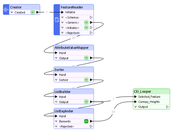
As the features had been captured by LiDAR, they overlap each other. I am trying to clip the features to show max canopy heights, if that makes sense. 0-1m will be clipped by canopy heights >1m, 1-2m will be clipped by canopy heights >2m, 2-3m will be clipped by canopy heights >3m, etc.
I don't understand how to set up a loop in a way that can filter and dissolve higher canopy heights. All feedback and suggestions are appreciated.