I want to categorize all properties across BC based on the federal electoral districts. I have the Esri Geodatabase file format for the federal electoral districts and have all the properties with their latitude and longitude information stored in a table. what will be the best approach to resolve this ?

Solved
Join Shapefile with property data
Best answer by fmelizard
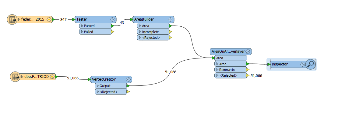
Hi @vakansha You're likely creating points with the VertexCreator. Use a PointOnAreaOverlayer instead of the AreaOnAreaOverlayer. Or use a SpatialRelator or SpatialFilter.
This post is closed to further activity.
It may be an old question, an answered question, an implemented idea, or a notification-only post.
Please check post dates before relying on any information in a question or answer.
For follow-up or related questions, please post a new question or idea.
If there is a genuine update to be made, please contact us and request that the post is reopened.


Login to the community
No account yet? Create an account
An FME Account is required to contribute
LoginEnter your E-mail address. We'll send you an e-mail with instructions to reset your password.