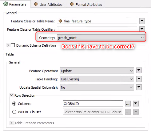
I have a workspace where I am reading spatial data from an Enterprise geodatabase, modifying only a single attribute and updating that attribute using a feature writer. I'm reading the data dynamically and want to write it dynamically too. The data consists of points, lines, and polygons.
My question is, when updating only a single field, and not spatial data, does the writer ignore the geometry type? Or do I have to split my data up into point, line and polygon before it hits the writer and specify the correct geometry for each type?


