Hello everyone,


I'm currently trying to make a path from a GEOJSON "link" which was return from a HTTPCaller. Is there any way to transform the link below into a line feature?


Thank you in advance.


This, below, is the GeoJSON file in question.

https://docs.google.com/document/d/1-H6F53Z3Mpu9qmOLQwvifWVPuG7xgjtk4aekHyG1nUU/edit?usp=sharing

This is quite doable.

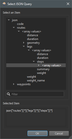
  • Put a the response in the JSONFragmenter and fragment the steps. JSON Query:
  • Individual segments
json>"routes"]
  • s"legs"]
  • ""steps"]
    • Complete route
    jsonl"routes"]
    • Flatten Query Results into Attributes and expose the attribute "geometry".
    • Use a GeometryReplacer to generate the geometry from the attribute "geometry".
    • Set the correct CRS, looks like it is WGS84 / EPSG:4326.


    The hard part is to find the correct JSON Query. The easy way to do this is to safe the JSON repsonse to a file, set the JSONFragmenters Input Source to File and then hit the "..." button to see and select in the structure. 

    2021-05-25_14h50_47Then switch back to JSON Attribute and select the response body from the HTTPCaller.

    Added a sample workspace template.


    Thank you Niels, much appreciated!


    Reply