Question

I am working with parcel data and I want to save the coordinate of the parcel displayed in the feature information dialog. Is there any way to save the coordinate for all the parcels at once and either save it as an excel or just transfer to SQL serv

  • October 3, 2019
  • 1 reply
  • 8 views

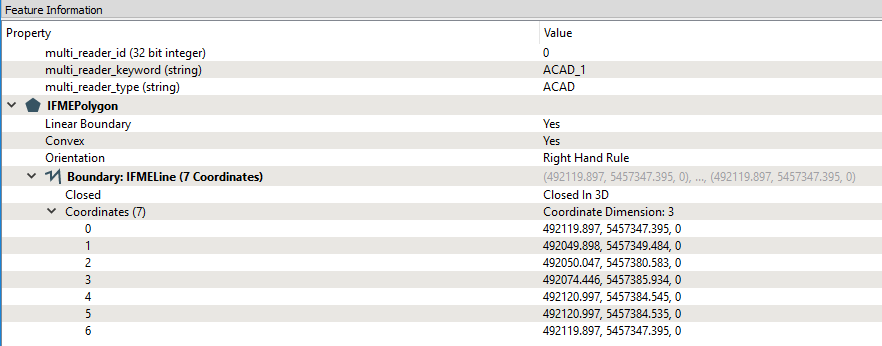
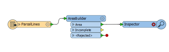
I want to save the coordinates for all the parcels in the map.

I have taken a parcel data in Auto cad dwg format and applied an area builder to it.

This post is closed to further activity.
It may be an old question, an answered question, an implemented idea, or a notification-only post.
Please check post dates before relying on any information in a question or answer.
For follow-up or related questions, please post a new question or idea.
If there is a genuine update to be made, please contact us and request that the post is reopened.

1 reply

erik_jan
Contributor
Forum|alt.badge.img+22
  • Contributor
  • 2179 replies
  • October 3, 2019

Have a look at the CoordinateConcatenator transformer.

That stores the list of coordinates in an attribute, that can be exported to any non spatial format.