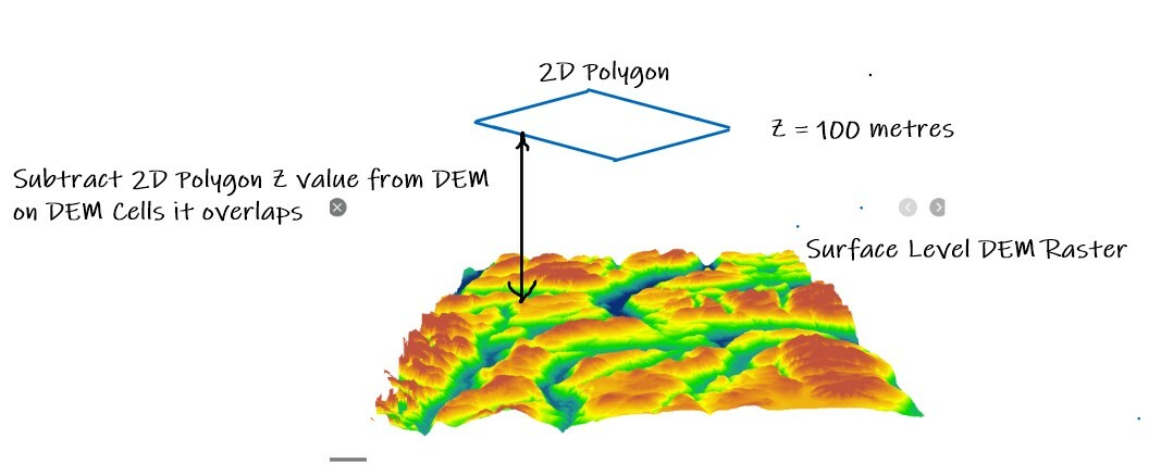
Looking at migrating one of my clunky ArcGIS scripts over to FME but is betraying my lack of experience with Raster Transformers!
It's somewhat straightforward I think, I just am looking for what the key Transformers are for the 2 following Steps:
- Subtract from a DEM Raster's Cell values the values in overlaying Polygons
- Build "Filled" Contours (ie. Polygons that contain Cell elevation values within certain range intervals)
Use case is water pressure contour generation. Hydraulically this is the imaginary Hydraulic Grade Line which at most times of the day is almost a flat surface (Hence the 2D polygons with an HGL attribute value) and subtracting the local Elevation from that (from the DEM) derives the local Water Supply Pressure.
My ArcGIS process migrating from builds a second Raster out of the Polygons, and uses that in a Raster Subtract ArcGIS Geoprocessing Tool to create a 3rd raster with the Delta Cell values, and then create Filled Contours from that, but I suspect in FME the Workflow would be a little different and maybe more efficient?


