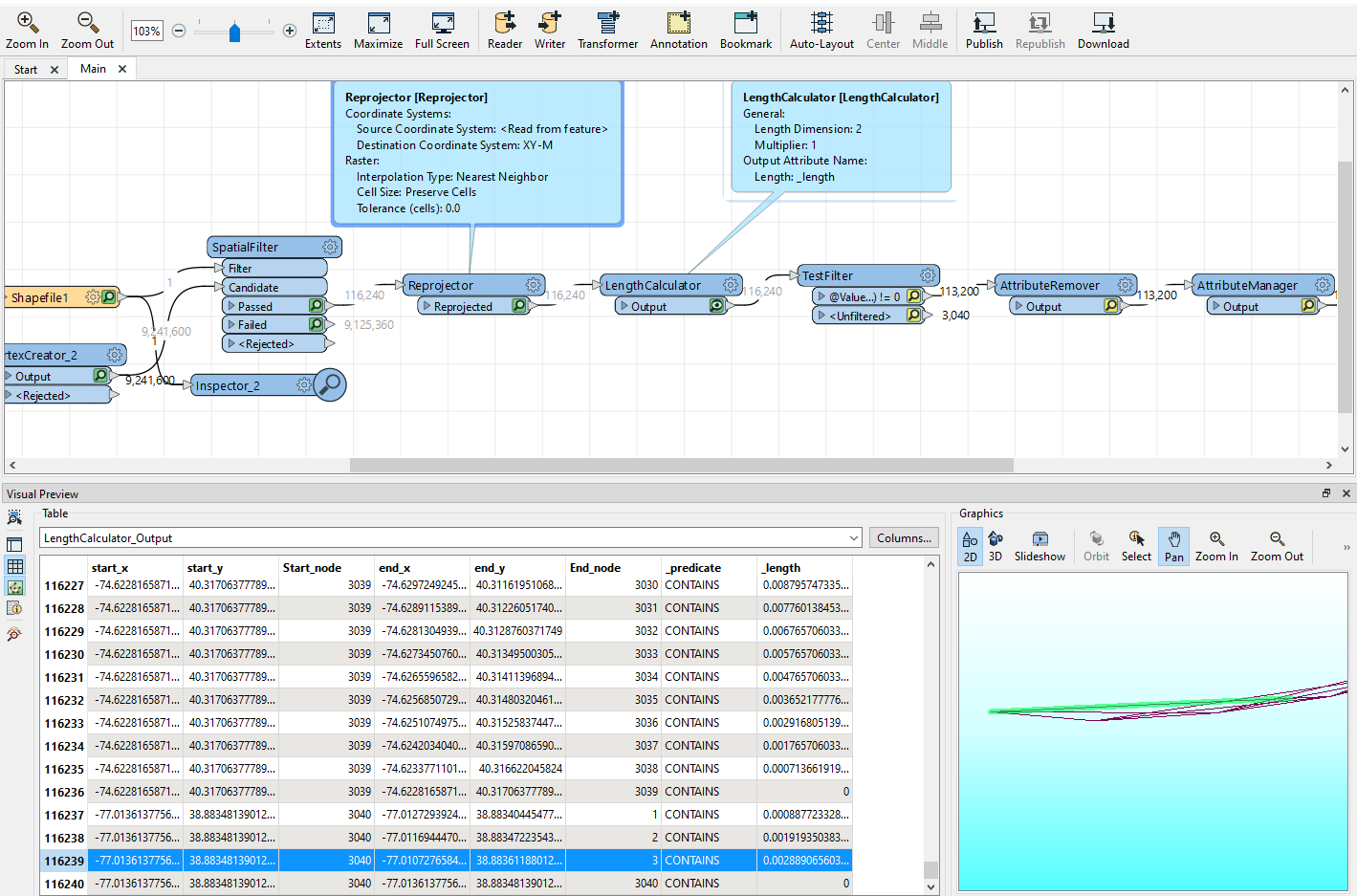
I have two input table I set to LL-WGS84. I need to determine the length of the lines after the SpatialFilter in meters. I re-projected to XY-M then used LengthCalculator but the resulting values are not in meters. How do I reveal the line length in meters?
 

image

Can you try reprojecting to AZMED (Azimuthal Equal Distance) instead and see if that makes a difference?


There's also the GeographicLengthCalculator on the FME Hub:

https://hub.safe.com/publishers/safe-lab/transformers/geographiclengthcalculator


Ok. I tried that but ended up with the same results. Sample distance is 0.11609942923451384


Reply