Question

How to preserve exact colors in raster conversion .ecw to .tiff?

  • May 1, 2014
  • 4 replies
  • 92 views

makt
Contributor
Forum|alt.badge.img+1
I am converting .ecw files to .tiff and notice that the resulting tiffs are "brighter". In dark areas, this seems to make the tiff look quite different and lower quality.


How can I control this brightness factor in a conversion?


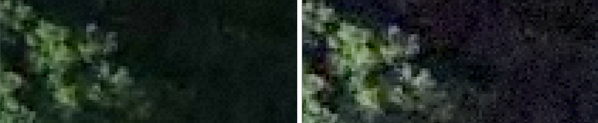
Below is a zoom-in example:  original ecw (left) and resulting geotiff (right)
This post is closed to further activity.
It may be an old question, an answered question, an implemented idea, or a notification-only post.
Please check post dates before relying on any information in a question or answer.
For follow-up or related questions, please post a new question or idea.
If there is a genuine update to be made, please contact us and request that the post is reopened.

4 replies

takashi
Celebrity
  • May 2, 2014
Hi,


It's not a direct answer to your question, but there might be a hint to solve the issue.


Geotiff has several compression methods. If you selected a lossy compression method such as JPEG when writing the image, pixel colors might be different from the original data. As well, ECW is also a lossy compression raster format, so pixel colors being displayed on the viewer might be different from pixel values read by the ECW reader depending on both the viewer characteristics and parameter settings of ECW reader.


For your information.


Takashi

david_r
Celebrity
  • May 2, 2014
Hi,


could it perhaps be a palette issue. Send both the source and target file to the inspector and check for palette inconsistencies between the rasters.


David

gio
Contributor
Forum|alt.badge.img+15
  • Contributor
  • May 2, 2014
Most likely a colorpallette or rasterbadinterpretation isue(?)

makt
Contributor
Forum|alt.badge.img+1
  • Author
  • Contributor
  • May 5, 2014
thanks for the hints thusfar.


In looking at this issue further - it seems that using data inspector, the tiff and ecw look identical. Its only when I use ArcGIS do I see the color differences.


It seems that FME is doing something automatcially with display, while ArcGIS needs to be told an extra step? Any ideas?