
I have a reader (file geodatabase) that contains about 900 polygons and want to use each feature independently as a clipper in a Clipper transformer, since I want to clip a few rasters based on that clipper. The result should be connected to that input somehow.

Solved
How to loop through a file geodatabase for feature classes to be used in a Clipper

") +11
+11- Enthusiast
Best answer by takashi
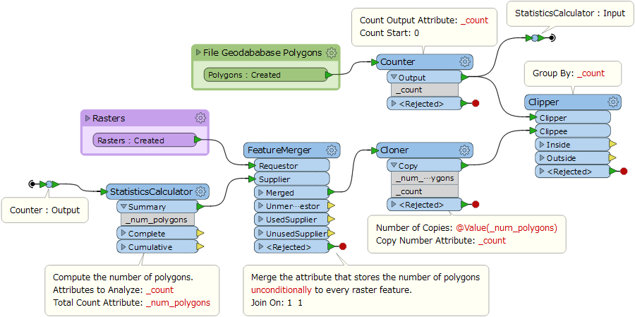
Hi @felipeverdu1, create copies of raster for every polygon (i.e. make groups of raster and polygon having 1:1 relation), then clip the raster by the polygon for each group. This screenshot illustrates my intention.
This post is closed to further activity.
It may be an old question, an answered question, an implemented idea, or a notification-only post.
Please check post dates before relying on any information in a question or answer.
For follow-up or related questions, please post a new question or idea.
If there is a genuine update to be made, please contact us and request that the post is reopened.


Login to the community
No account yet? Create an account
An FME Account is required to contribute
LoginEnter your E-mail address. We'll send you an e-mail with instructions to reset your password.