


I’m working with getting raster imagery in the area of interest out from the WMS. It’s the Land Coverage WMS. (https://dmsdata.cr.usgs.gov/geoserver/mrlc_Land-Cover-Native_conus_year_data/wms?)
End goal is to clip the Raster out from WMS into smaller area, and I need to be able to write attribute table showing the value number & RGB value in the Raster.
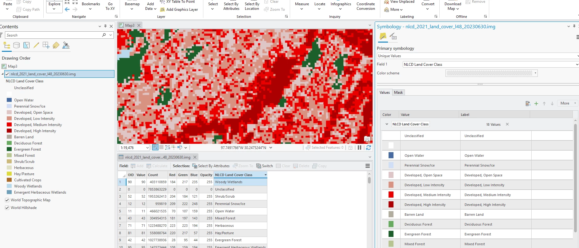
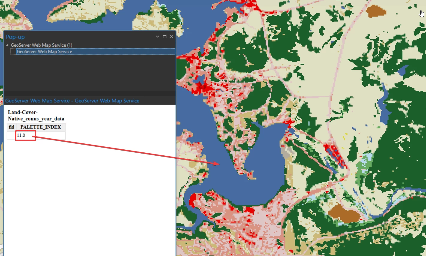
The issue I’m having is that the Palette index seeing inside ArcPro and FME is different. (Approximate location, SE corner of Possom Kingdom Lake, Graford, Texas, USA.) (32.856463, -98.431004)
Screenshot from ArcPro. When clicking Blue (Water) the value is 11.
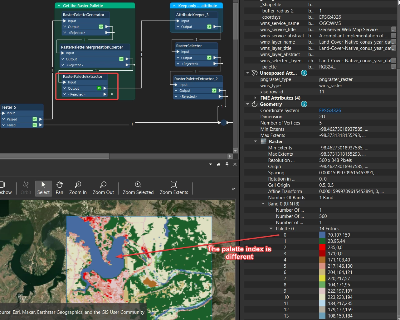
Screenshot from FME. When viewing the Palette after using RasterPaletteExtractor it showed Blue as 0. and I cannot figure out how to get the value “11” out of it.
Also If anyone can help me figure out how to write the raster file out with attribute table that would be greatly appreciated. I’m quite new with Raster, so I’m not quite now what I’m doing.

