Like
Projection
Standard parallel (s)
Longitude of origin
Unit
False easting \\ northing

 +1
+1Like
Projection
Standard parallel (s)
Longitude of origin
Unit
False easting \\ northing
Best answer by erik_jan
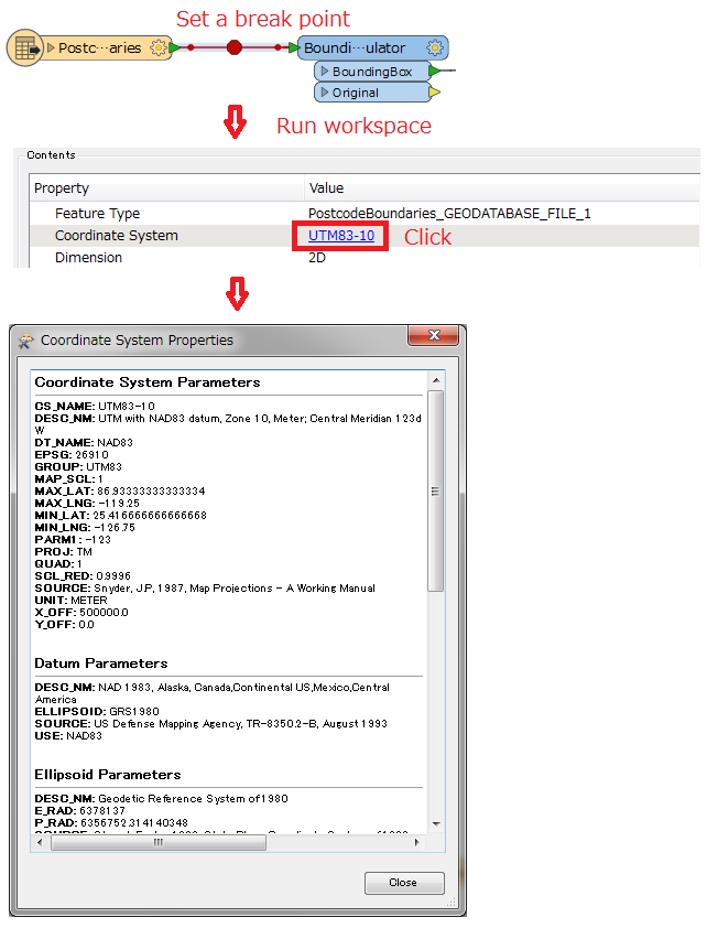
The name of the coordinate system in the data can be retrieved using the CoordinateSystemExtractor transformer.
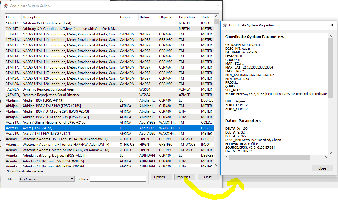
Using that name, go to the menu Tools > Browse Coordinate Systems.
Using the properties button you can view the settings for the coordinate system of your choice:
No account yet? Create an account
Enter your E-mail address. We'll send you an e-mail with instructions to reset your password.