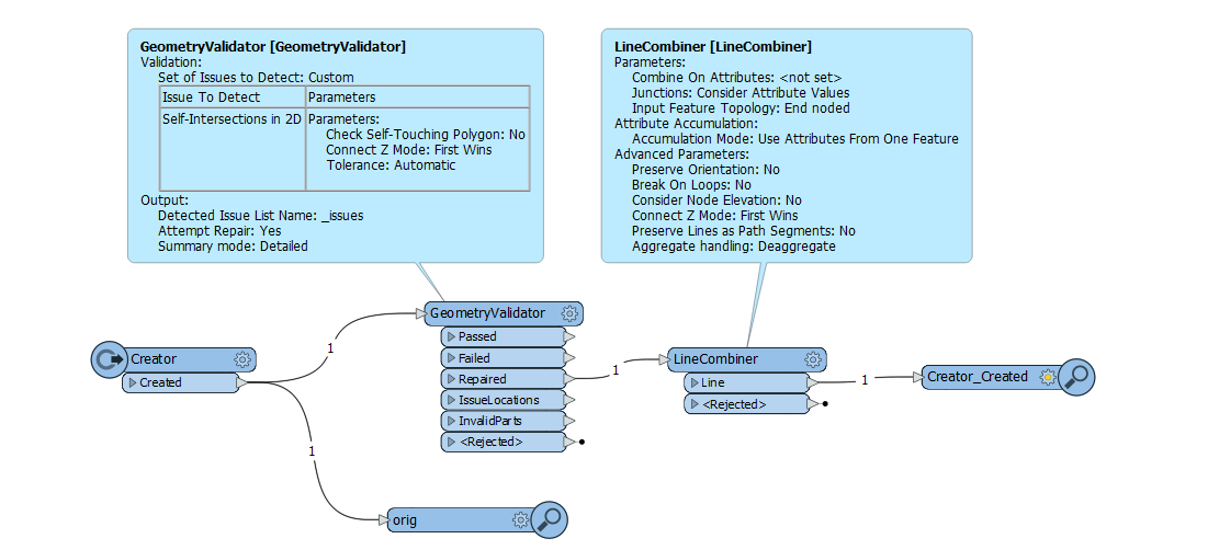
I have lines imported from Autocad to a GIS system, and it seems that the digitazing order of their vertex are not valid for the GIS sytem (e.g. endpoint is on a vertex in the middle of the line).
I was wondering how could i correct this order? My first thought was to use a chopper with 2 vertex and then merge all the segment together (LineCombiner) but maybe a transformer does this in one shot.
Any idea?