Dear All,
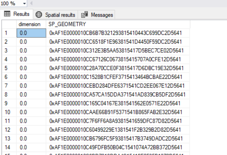
We need to convert TAB files that contain annotations similar to the following into a SQL Server spatial table with point geometry and an attribute to represent the annotation
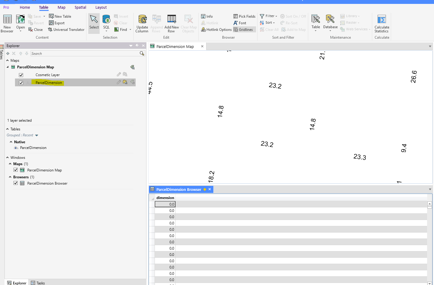
I have created the following workbench but it does not update the “dimention” attribute with the annotation text available in the MapInfo TAB file
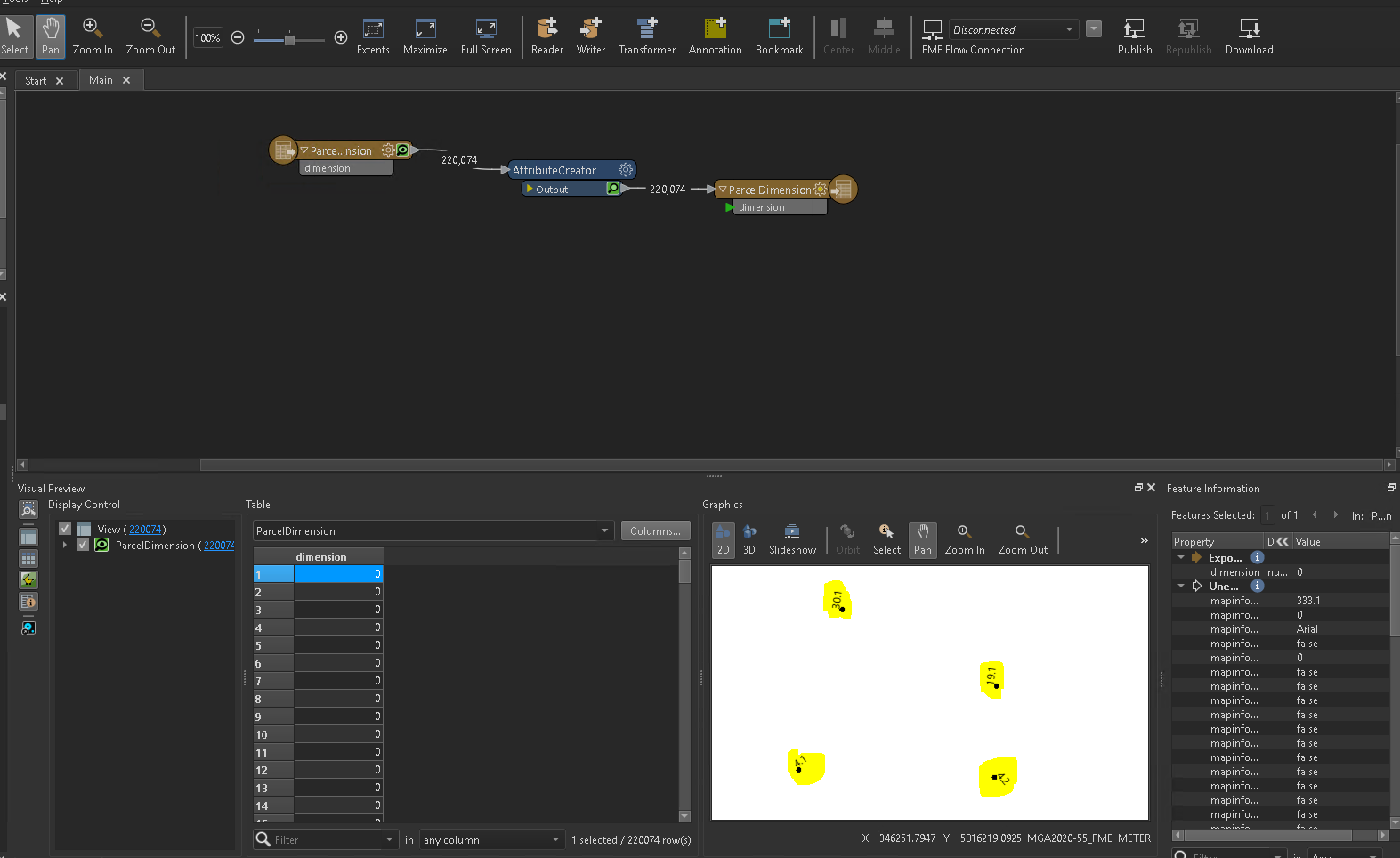
Output